|
"… 'Cause two out of three ain't bad" The words went through my head on yesterday's century ride. I had plotted a route to Sodus Point / Sodus Bay area and as I often do, I allow Ride With GPS to make assumptions and serendipitously suggest the way. RWGPS is pretty smart for a brainless web-app, and doesn't often steer me wrong. But it's database isn't 100% up-to-date, so when things change … like roads getting closed … it doesn't always find out. But I do! After leaving Sodus Point southbound on Route 14, there's a side street called South Shore Road that I've always wanted to explore but never seem to have made the detour. Alas … RWGPS sent me that way and I dutifully followed my instructions. I immediately sensed that this might not work when I saw the string of fancy vacation homes along the shore with a view of the bay on a narrow street. This does NOT get thru-traffic, certainly. And the "No Outlet" sign confirmed it. But, on a bike "No Outlet" and "Road Closed" signs can often be interpreted in other ways like "Difficulty Ahead", "Hike-a-Bike Required", or maybe "Look Around, Be Quite, Ride Fast". Sure enough, I came to a spot where the road ended at a driveway, but I could see where the road continued on the other side of a manicured lawn between a couple obscenely expensive properties. It's a weekday, nobody around, and it takes only 15 seconds to cross one-man's land. As I pass the golf course nearby, I calculate the odds that the homeowners are club members as well. 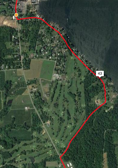 South Lake Road @ Sodus Bay Shortly after, back out on Route 14, I take a favorite side trip down Red Mill Road and come to Ann Lee Drive. I've looked at that road on a map from the opposite end where it's named Spiegel Drive and remember that there IS a "Dead End" sign there … but not on THIS end. (Yet) Wouldn't you think I'd piece it together that they are two different roads, and thereby two different names. I didn't, so down Ann Lee Drive I go. Eventually, I DO run by a "Dead End" sign, but I'm already headed downhill with a tailwind and I'm not about to stop. Might as well be prepared to eat it and have to climb back uphill into the wind just for the sake of future knowledge why NOT to go this way. Again, the road (with no thru-traffic happening) ends at a driveway, but with a rusted old gated barrier looking what appears to be an old, now abandoned and grown over driveway. My satellite view shows Spiegel Drive on the other side, but it's not in sight through the woods. I compare the effort of hike-a-biking for a unknown result thru the woods to the long uphill headwind backtrack. Not entirely fond of "hike-a-bike" in the mud, but I hate "backtrack" as a word. I go. Sticks get caught in my drive-belt, mud cakes up on my shoes and tires and clogs in my fenders and my thoughts revert to Baja California until I see light through the trees. Sure enough, I see pavement connecting to a dirt driveway that leads me past a couple cabin-like homes. I quietly remount at the dirt and spin quickly outta there, out Spiegel and out to Ridge Road. 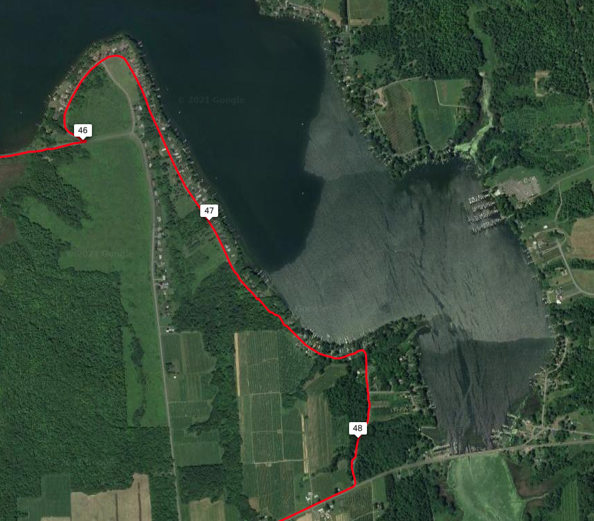 Ann Lee = Speigel Road ... Sorta So far, I've done everything RWGPS told me to do! South and westbound from there I eventually get to Fish Farm Road. I wonder why it's called Fish Farm when ALL the farms around me are apple orchards. Whatever. Then an AHA moment! I recognize the issue I've contemplated before. I've arrived at the entrance to a gravel road that disappears up over a hill headed west off Fish Farm Road, flanked with apple orchards on both sides. Clearly, this must be private property. RWGPS says go that way. But I've looked at this on the maps before and wondered how that could work. I look around. No people anywhere, so I slowly start climbing up the rocky gravel … just to see ya know. Atop the hill, there's a house right next to the road (path?) and there's a car in front and house windows facing the road. I look ahead down the other side and can't tell if the road actually continues or not, but it's certainly private property as far as I can see. Sadly, I give up on the fishy road and return to Fish Farm Road to have another look at the satellite image. It's just not clear. I lose. 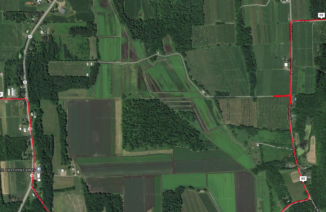 OK … Two Outta Three Ain't Bad. The re-route around the bogs below turns out to be a really fun ride …. it's on a couple club maps, of course … and I get back on the RWGPS track at Snyder Road and continue on to Marion. At Marion, I get a photo of a spot I'd seen before. 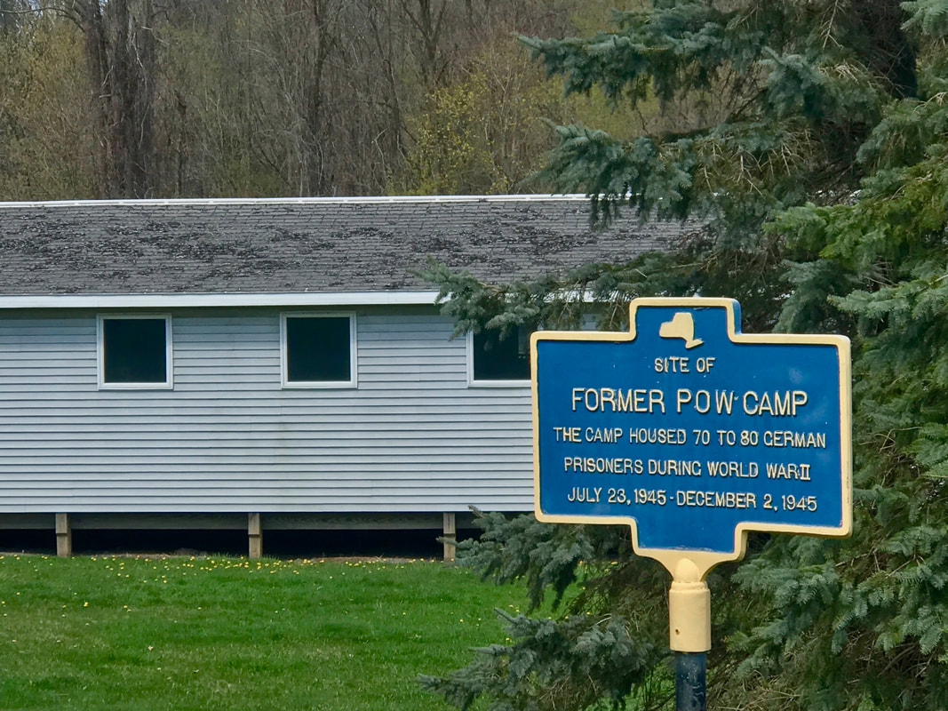 No Words I guess this was as good a place as any if you wanted to be sure there was no place to escape to. I wonder if the people in Marion still feel that way The building had a huge Trump flag drooping above it. I veered off the RWGPS track after leaving the coke-break stop in Walworth and headed for the canal trail to get back into the city. Again, I prefer to do an intra-muscular injection into the city via the car-free canal trail, rather than expose myself to the detritus of the skin of the suburbs. It was a long day (108 miles) … 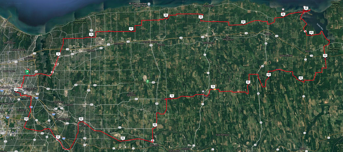 … even with only four stops. First at Kent Park outside Webster to make adjustments. Third (what happened to second?) in Sodus Point: a stop at the historic lighthouse … 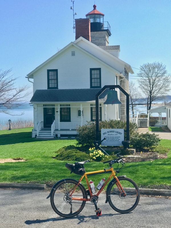 Sodus Lighthouse … and the out and back to the beachfront where I met an EMT taking a break. I asked her what all the construction work in town was about and she said she just got assigned to this area and didn't know. On my way back out, I met a couple homeowners on the street that was all torn up. They shared that the whole town was getting new utilities, bike lanes and break wall repairs and everything would be done by May. Last stop in town was a Coke and Nacho Cheese Doritos stop at the gas station. The forth short stop at the gas station in Walworth was a Coke and Reeses Peanut Butter Cup! That should get me the last 30 miles to home. But the highlight of the day, and the big time loss, was early in the ride at stop #2 when I finally side-tripped into Beechwood State Park. I've been by here a million times but never took the time to check it out. Today was a gorgeous sunny day so, why-not? 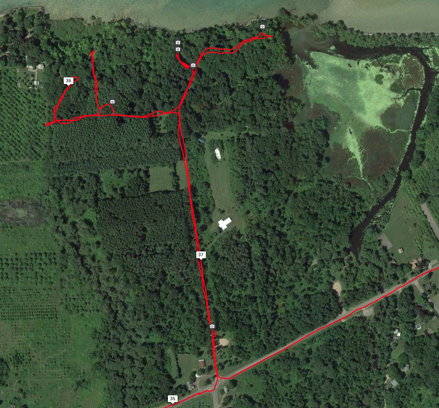 Exploring Beechwood State Park What I discovered is a pine forest that is owned by New York State but managed by the town of Sodus. The property looks like it's been abandoned by the state but in fact is a stunningly beautiful property along the shoreline of Lake Ontario. I ran into a group of hikers from Wayne County's "Trailworks" who were out hiking, and they shared the details. It was once a Girl Scout Camp, long ago, but later handed over to New York State. There's an effort to revitalize the park, and I'm inspired to help by gathering a group of like-minded cyclists for a camping outing sometime this summer. Who's in? See the photos below and get inspired! 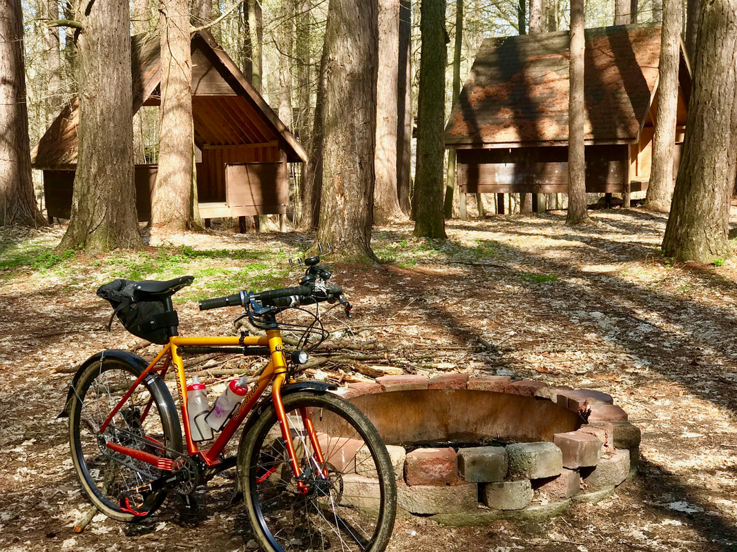 Sheltered Camping! Complete with Fire Ring! 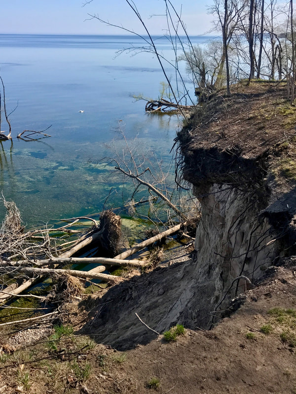 Dramatic Shoreline 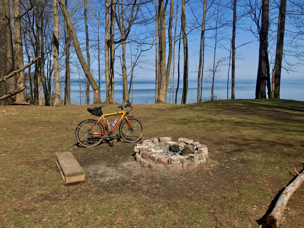 Perfect Tent Campsite! See the track file and zoom in to check out the Beechwood Park: https://ridewithgps.com/trips/65508884 Rubber Side Down!
0 Comments
Your comment will be posted after it is approved.
Leave a Reply. |

In the Finger Lakes

Slow Rides
Archives
October 2024
|
 RSS Feed