|
What a Great Year! On each of my century rides this year (in fact, ALL my rides), I've recorded a GPS track file with my smartphone and saved the details. Importing all 25 track files into Google Earth results in this: 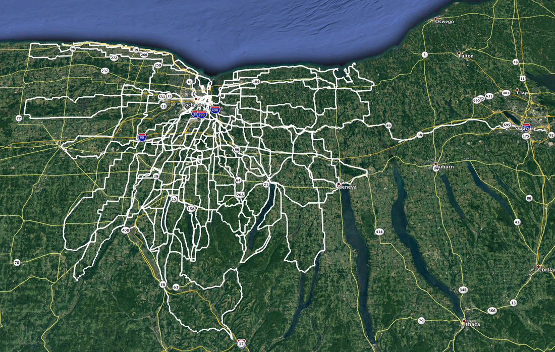 And that's just the centuries. It doesn't include all the other rides, solo, with friends and club rides, that to date total just over 9500 miles. The centuries (and double metric centuries) alone account for 2,879 miles. All but one of these centuries started from my back door. The only remote start was the Neil's Creek Century with Joe V. starting from Geneseo, and that's the only century I rode with anyone.
Compiling the stats, I fully expected to see that I did 10 of the centuries on my Rivendell Sam Hillborne "country bike", as Grant Peterson calls it. My Co-Motion Pangea and (surprisingly) the FrankenTrek each accounted for 5 and the remaining five were split up between my Surly Long Haul Trucker (2), Old Blue (2) and even my rarely used Bachetta Giro recumbent got in on the game (1). I did two centuries in "Moderate March", laid low during the crappy weather of April, but came back with a vengeance over May (5), June (6), July (4) and August (4). September began the slow down (3) and I wrapped it up with one last shot in October. Sadly, I haven't saved all my non-century rides tracks, but if I had saved all those to Google Earth, it would probably look like I took a wide paint brush and painted all of Monroe, Wayne, Ontario and Livingston counties. And I still have 500 miles to go to hit my 10K goal for the year. Maybe next year?
0 Comments
For as far back as I can remember, and likely long before that, the Season Finale ride of the Rochester Bicycling Club has always been the Webster Wander at the end of October. 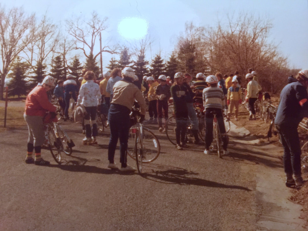 ======================== Above: Webster Wander circa 1979 / 1980. Paused at Inspiration Point Road. The late Dusty Miller, former Membership Chair, in the orange jacket at far left. Maybe Andy S. in the green sweatshirt? Likely Carolyn K. in the blue and yellow shell in the back right side? ======================== Yes, the club always kinda "quits" before winter, officially anyway, but many people ride deep into fall and some of us never quit at all. Impromptu rides by individuals and small groups of friends can still happen since our club uses Meet-Up to make the arrangements and I'm certain the next impromptu ride will likely get posted soon, since the Irondequoit Bay outlet bridge will soon swing shut to boaters and reopen to road traffic the first of November. But first, we wrap it up with the old Webster Wander classic, and yet again this year, the route was revised, but for different reasons. Over the years, the route has had a number of revisions based on volunteer members in the Webster area being the "host home" of the cider and donut stop. Even Karen and I hosted it for a while before we moved into the city from Webster. Our friends Ann & Steve have been hosting it for several years but wisely opted out this year due to the pandemic. Even with no cider and donuts, we still had a good number of folks join the ride this year, and the payback for the adventurous was no snow or rain (for once!). So of course, I just had to expand the day's ride a bit by riding to and from the ride, turning the 28 mile ride into a 60 mile wiggle. 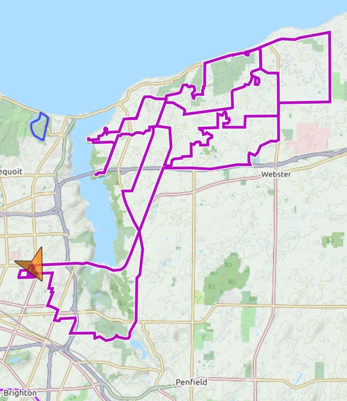 And much of it was trail riding … on the Pugsley, of course! Heading out to the start, I used a stretch of the Webster Bikeway, North Ponds Park, and the Bird Sanctuary Trail. On the way home, I visited the trails in the Whiting Road Nature Preserve and Gosnell Big Woods. I was riding with Karen when we passed the Four Mile Creek Preserve, so opted not to cruise in there … this time!
Sometimes I miss living out in Webster just because there are so many quiet roads and streets to wander, but I'm certain that thousands of this year's miles on the ticker were accumulated just within the borders of Rochester, so it's not like I've given up much. And Webster is right next door and available anytime. And speaking of "miles", as of this writing, I've logged 9,468 miles of my 10,000 mile goal for 2020. 532 to go and counting down … rapidly. Finally. After nearly a month "off" (from century rides), I finally got a nice weather-window day and jumped at the chance to knock off Century #25. And because of my preference to ride my centuries in daylight, I'm rapidly (or so I thought) running out of daylight to get the last one in before winter. With that in mind, I donned my hi-viz, rigged up the fast FrankenTrek with blinkies and set out before sunrise yesterday. In the city, there was enough light to navigate my way out of town; straight out across the center city and out Lyell Avenue (nicely paved with a bike lane too!) into the country and got to watch a beautiful sunrise in my mirror. I was headed west. I was determined to return before sunset no matter what. I grabbed the FrankenTrek which I can count on for fast riding, but old 700-23 tires that I'm convinced are jinxed (a flat on most rides is "normal") raise the threat of delays. And what do I do to mitigate the risk? Rather than mitigate, I only increased the odds of flatting, if not sustaining actual damage, by heading to the Iroquois National Wildlife Refuge. In the flat farmlands roughly halfway between Rochester and Buffalo, there are a pair of land management areas lying in a broad swath of lowland / wetland areas of which the Iroquois NWR is one, and the Tonawanda State Wildlife Management Area just west of there is the other. Our club has a short ride out around the Iroquois refuge (22 miles: RBC#35 - Wild Goose Chase) that we used to run years ago in the spring during the Canada geese migration season. Initially, Having never visited there, I thought of going out PAST the Iroquois refuge to the Tonawanda Area, but that would have added another 15-20 miles to my route further risking my odds of getting home by dark. Or so I thought. I had a very slight tailwind as I headed westbound on mostly quiet, flat and reasonably fresh pavement for most of the stretch. I was shocked to find myself entering the refuge on a dirt road (45 miles) in only three hours. 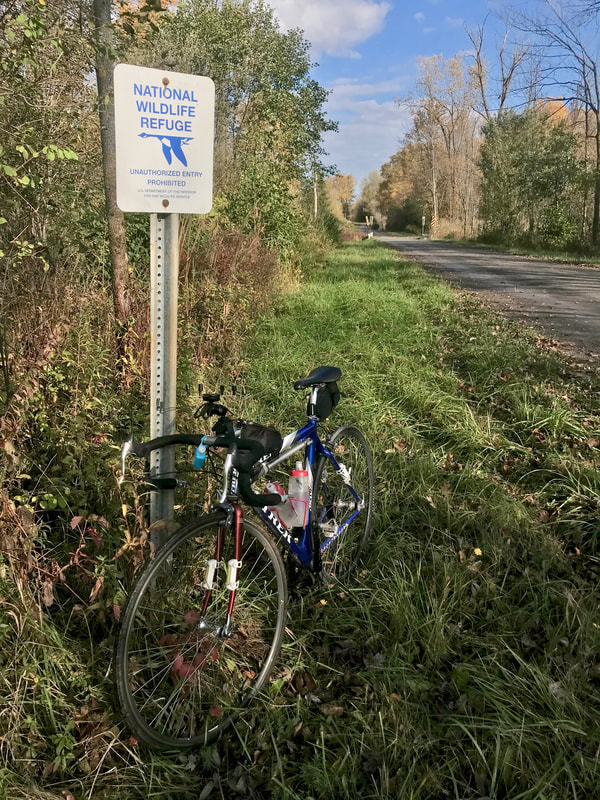 Signs indicated that a bridge was closed ahead, but on a bike, I ALWAYS go ahead to check because bikes can frequently get through / across / around when cars can't. As luck would have it, a "car" bridge doesn't exist over the creek, but a pedestrian bridge does and leads to a short stretch of hiking trail to connect the two ends of Sour Springs Road. And it's "ridable", even on skinnies. 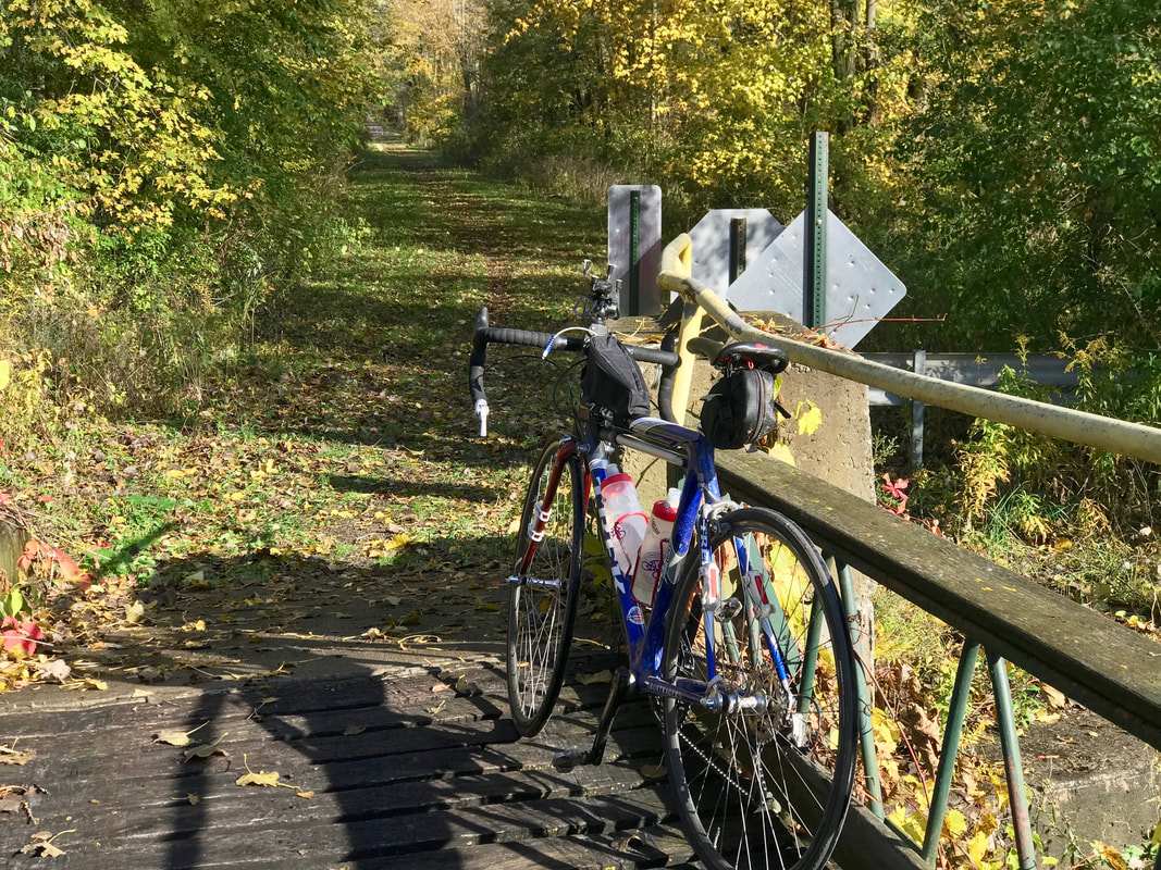 Watching closely for "obstructions" under the tall grass and wet leaves, I proceeded down the trail till I got back on dirt leading to a viewpoint overlooking a marsh jammed with Canada geese and what I believe were loons. I should say "I believe" because although upstate New York is just barely south of the currently recognized range of loons in North America, I KNOW their sound intimately having spent a week vacationing at a cabin in the lakes region in far northern Wisconsin. I witnessed a strange phenomenon; perhaps just a coincidence. As I sat by the marsh eating 1/2 a cliff bar in the sunshine, a cloud passed over putting the pond in shade and suddenly, over the racket of a couple hundred geese, I hear the sound of loons. Spooky man! 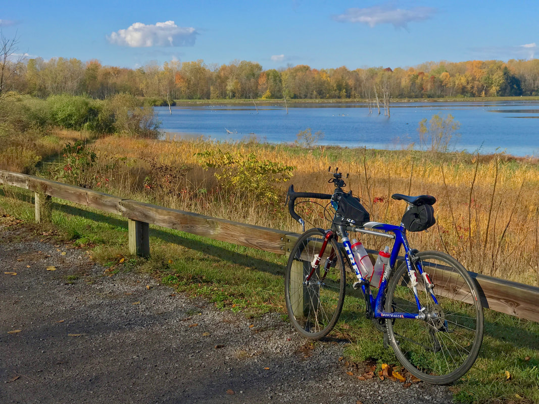 STILL hoping to get home before dark, I only paused for a few minutes and hit the road. The southerly winds weren't strong (yet) but were either headwind, tailwinds, or crosswinds depending on which left-right or right-left sequence of turns I made to essentially head east till I snagged the canal trail. Closer to the city, the winds picked up, and heading around the south end of the city on the trail put me squarely into the headwinds. No matter. I hammered out 102 miles in under 8 hours simply because I only stopped twice. The second time to eat the other half of my cliff bar at Long Pond Road where there's a couple benches next to an interpretive sign describing how "The Deep Cut" in the canal was constructed. Worth stopping for if you are out that way. On the road at 7am and home before 3pm. Guess I could have gotten to the Tonawanda area after all, but I'm happy with the day's ride and now I'm "off-the-hook". With goal #1 exceeded by 15 (I initially planned only TEN centuries this year), I only have 600 miles to ride to hit goal #2: 10,000 miles in 2020. Or, maybe 11,000? 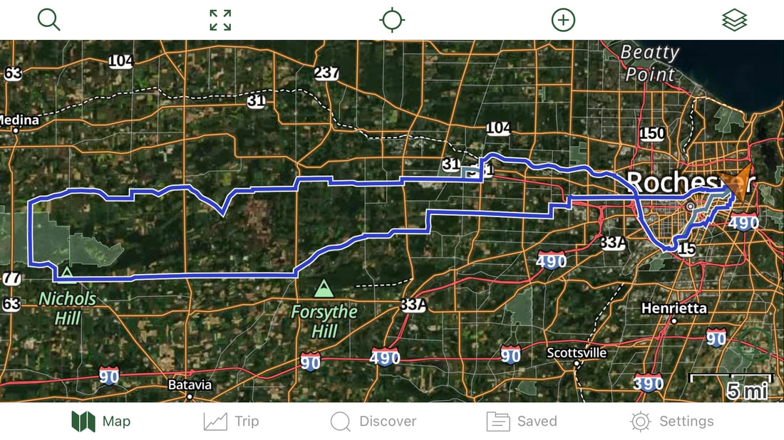 Damn, I Love This Ride! RBC #150, Lyons Hollow, an "Adventure Ride" in club parlance but likely called a "gravel grinder" in modern times, is a 26 mile dirt/pavement mix in the hills south of Naples NY. One look at a topo map of the area immediately reveals that ANY bike riding in the area will involve some effort. The club's gps track file indicates the route has about 3,500' of climbing. Three of us met at the ride start on Sunday morning October 11th for some thrills in the hills. I took my Co-Motion Pangea with the totally appropriate Pinion gearbox for easy climbing, but with totally inappropriate 1.5" street tires ... just for fun. Jay had his cross bike with more appropriate tires and Les wisely brought a full-squish Ibis.  It was a little cool at the start, but sunny, and by the time we reached the 1st hilltop (1,200' gain in altitude after only 5 miles of climbing, part on dirt), zippers were getting pulled and layers were about to be shed. A couple more drops of 400' and back up to 2000' altitude bring us to the top of Eveland Road. 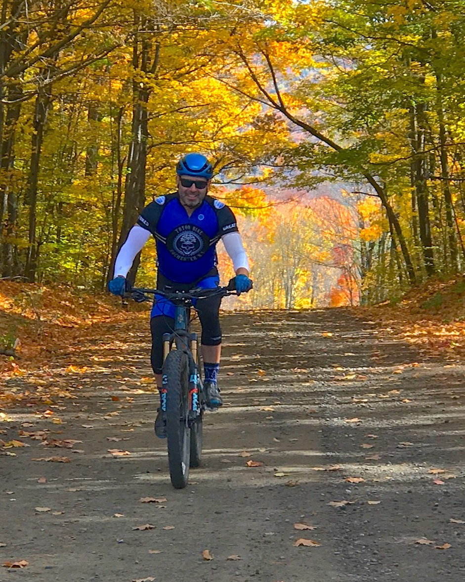 Depending on the season, recent weather, and when this "seasonal use" road was last graded, you never know what condition it might be in. Sometimes, it's been pretty ragged and washboarded, and in the fall, leaves cover some details you would much prefer remain visible as you try to pick a line that beats you up the least. But sometimes, it's in decent enough shape to let the bike rip. Jay and Les took advantage of their more appropriate wheel choices and took off, flying out of sight in no time. I, on my skinny wheels and rigid frame, resigned myself to a slow wander down the road thinking I should let some air out, but decided otherwise to save the others from waiting too long for me. 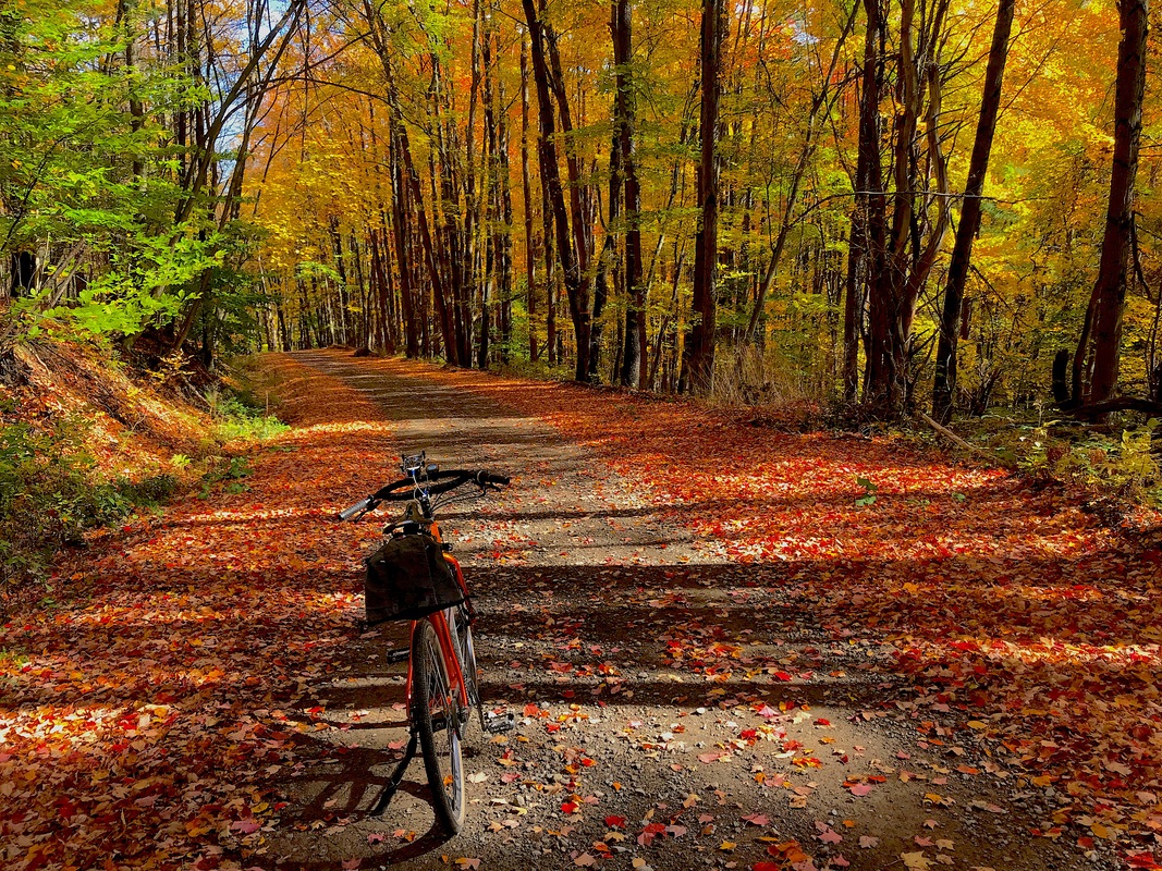 I mentioned the physics trade-off I had to make to Les and he got it. On the one hand, if you go fast enough, you minimize the impacts of washboard by skipping over the tops. On the other hand, if your wheels are only touching ground intermittently, you are technically out of control. Fun choice! At the bottom, Jay decided to take 12 Mile Creek Road. The next challenge is climbing up Lyons Hollow. But unlike nearly killing myself by riding a single-speed up there a couple years ago, I used nearly all the insanely low gears on my Pinion drive and quite easily crested the top still breathing "normally", whatever that is for this route. Todd joined us at the top of Lyons Hollow by riding the route in reverse to intercept us. He was already in the area at his cabin nearby and pulled out his vintage Klein Attitude he keeps there. Good gearing AND good tires. 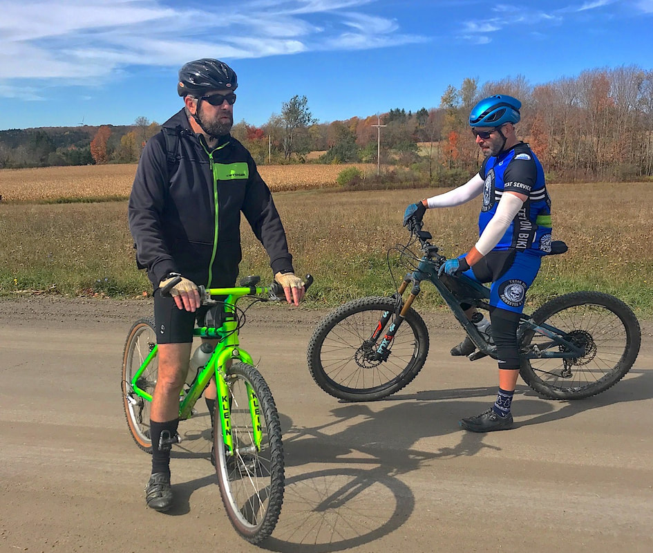 After meeting Todd at the top, we moved on down Cook School Road (a bit rough again in places), down Route 53 to the base of Dillenbeck for a two mile climb up to the final crest. Again, I was left in the dust picking my way down Clute to Italy Valley Road where Todd broke off to get back to the cabin. Les and I now looked forward to the last big descent into Naples. The first part of East Hill Road rolls along on pavement before turning rough again for the steep part. Les disappeared again and I took likely twice as long to reach the bottom. I've seen motorcycles with full-on knobbies lose it on the tight downhill turns, so I'm in no hurry. Like all great rides, this one finished under perfect weather and without damage to bikes or bodies, but this one had a special treat! The new ride start location for Naples rides, starting from the high school, is right across the street from Cindy's, the long-time grape pie bakery. Of course, we supported the local business. In these times of economic stress, it's the least we can do. 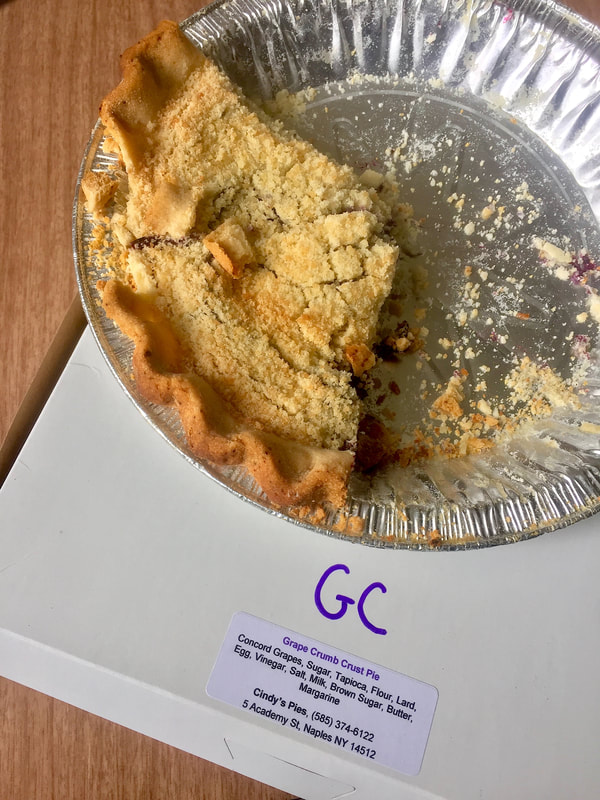 RBC #222, the Neil's Creek Century, is a real favorite of mine and you can guess my reply to Joe's invitation to go ride it Sunday. Yes, it's a long hilly ride, and with shortening daylight hours, I had to think about what bike to ride. A bike with generator and lights? Go light with the fast bike and try to finish before sundown? These thoughts came to me as I've been getting started on long rides at sunrise, and those have been getting later and later. Sunset too has been getting earlier, so what got into me to suggest a start time of 8am rather than 7am, I don't know. Maybe I figured Joe might not want to start early, but yes … Joe has lights on his rando bike. Maybe I figured it shouldn't be too tough, as it is a "moderate" ride in terms of hill climbing … just over 5,000' over 101 miles. So 8am it was, and I pulled the FrankenBike out in hopes we'd finish before sunset. I shouldn't have been concerned even if we did run past sunset. Joe has good lights and I had front and rear blinkers. Never mind that we chat a lot and didn't hit the road till 8:14am! And then there was the wind. 10-15mph headwinds from the south and southwest made for a slow start uphill toward East Groveland. I began to question my bike choice until we hit the top and flew down Groveland Hill. Top speed of 44mph even with the crosswinds. Okay … we're good. I know the rest of the ride is like this. Up. Down. Up. Down. But nothing too brutal. (As long as we avoid Jacob's Ladder!) We pass through Dansville and start "the climb" of this route. Up Sandy Hill Road through South Dansville, then the turn onto Mack School Road where we top out at just over 2000' elevation. Another wild downhill to Route 21, then the "Main Event" of this ride, Neil's Creek Road (CR6). Payback time. Neil's Creek, in the eastbound direction, is a 7 mile long winding but mostly gentle downhill, twisting alongside the creek which has carved itself a nice canyon-like setting in places. 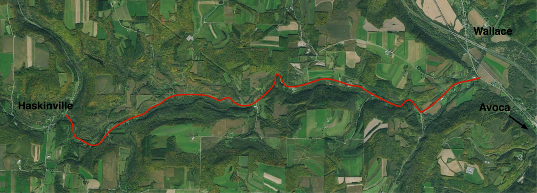 The competing temptations on this stretch are: 1. Cruise slowly and enjoy the scenery, or 2: Go Like Hell.  (Uh ... spell check!) We rode somewhere in the middle of the extremes. No rush … we're stopping in Avoca for a pizza break, and then head up to Wallace and pick up Twelve Mile Creek Road north toward Naples. Twelve Mile Creek Road is almost the opposite of Neil's Creek, in that it's a long gently rolling UPhill to Ingleside where we catch the fast downhill to Naples on Route 53. Eelpot Road out of Naples climbs away and back to Route 21 where we pause for a photo at Karen's favorite little store in North Cohocton.  Our second real break is in Wayland after a dead quiet cruise through Atlanta on CR36 to Sawdust Road. While watching the throngs of motorcyclists gassing up at the gas station, I'm approached by a young woman who asks if I've been to Canandaigua. Yes, frequently, why? "I've met you there!" Oh yeah. Maybe I've been spending too much time hanging out at Dalai Java on Main Street. So we hit the road up Pokamoonshine Hollow to Carney Hollow Road. And guess what? We have tailwinds now and they were a nice help in pushing us up the road. I mentioned to Joe that I far prefer getting up to Webster's Crossing via Carney Hollow rather than climbing out of Springwater on NY15. Joe agreed. We make the drop to water level at Conesus Lake by bombing down Sliker Hill. From there, we have about 5 miles of flat lakeshore cruising …  … before the final grunt of the day UP Reservoir Road back to Geneseo. We make it back to the cars just after 6pm. How about that! 101 miles in just under ten hours. 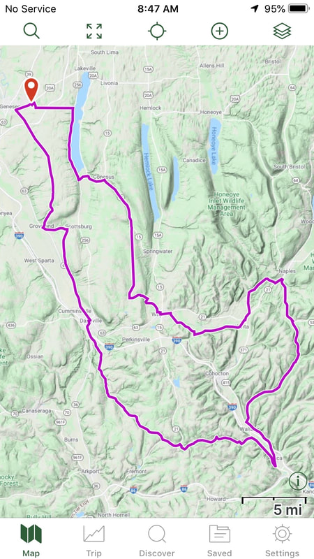 Just like nearly EVERY other ride we do, we average about 10 miles per hour overall. Flat. Hilly. Windy. No matter. It just always works out that way.  I wanted to take advantage of the beautiful weather predicted for the day, and the noticeable north-westerly winds dictated a north/south orientation of the route. Then our friend Kathy posted a 45 mile club ride with a start in Honeoye Falls. Too convenient! I could get up early, ride to the start and ride home afterwards, adding whatever miles I needed to get 100+. I plotted a meandering route both to and from the start with my track file including the RBC route #114, Honeoye Falls - East Groveland. With a ride start at 10:00am, I had three hours from sunrise to ride 25 miles to get there. It turned out, I got there waaaaay early and killed time by killing miles around the area, occasionaly swinging back to the start to check on show-ups. I ended up with 40 miles on the ticker before we even started the ride. And what a ride! Yes, weather was near perfect. 70's, and had winds that helped more than hurt our progress. Small group, just myself, Kathy and Steve, a new rider Christine, and Jack and Lou who did the 25 mile cut. We veered off the route a little bit on the way to Geneseo where we took a break at Byrne Dairy (spicy chicken sandwich!) and enjoyed the free ride with tailwinds down to the turnaround at East Groveland. Even on the return, the winds seemed more cross than headwind, so we continued smoothly rolling along till we bombed down Reservoir Road to the Conesus lakeshore. One more stop at Lakeville for a drink, and we headed on back to Honeoye Falls.  Returning home, I had a 30 mile loop planned, but as I got in extra miles in the morning, I didn't need to follow it to get my miles which I had "planned" for 100 exactly. I took a cracker break at Mendon Ponds on the way home. I can't seem to avoid riding through the park when heading home from the south. At home, I found 112 miles on the ticker. 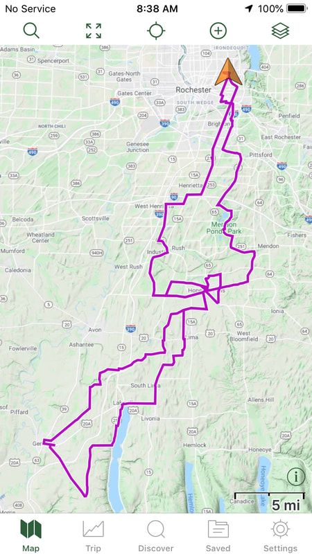 Getting Close! Just two more big rides this season and I'm done … with Centuries anyway. Still need to hit my 10K goal but as of this writing, I'm about 8400 miles in. As days are getting shorter, I may need to stick with the fast FrankenTrek to be sure I get my last two centuries in. I think I've got this!
Sometimes, ya just get carried away. For instance: I've been planning to do a tour of the Erie Canalway Trail from Rochester to the eastern end at the Hudson River / Albany area. 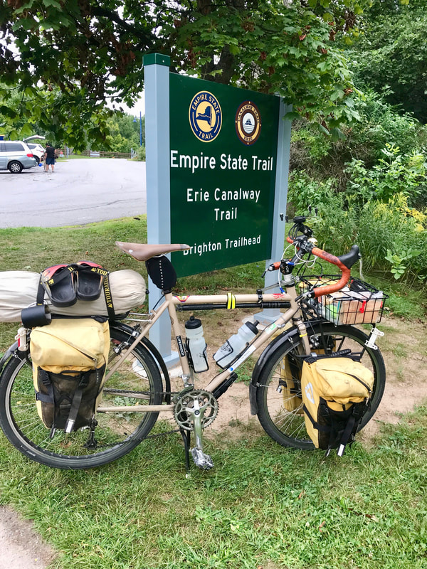 My thinking was I would load up the bike with all the "luxuries" of a loaded tour, including a stove and cook kit and extra sets of on and off-bike clothing, and really comfy camping accommodations like a TWO person tent and warm clothing. The idea was simply to go easy, shoot photos, investigate historic sites, and just have a nice gentle ride. Maybe I'd take 5 or 6 days, then turn around at the end, and maybe spend even MORE time coming back once I got a feel for where things are. Sound Great? Yeah. Right. Someone didn't really do his homework. Someone should have planned out exactly how far each day would be and make arrangements for every night's layover. "Winging it" isn't always the best plan. One the first day out, I figured I'd do maybe 50 miles and camp somewhere near the Montezuma area. I had identified a couple optional sites. I didn't exactly "twiddle" to Clyde, since I've already ridden all that part, so I kinda "made time" to Kee Kee Run Cafe in the town square … by 1pm. After a leisurely lunch, I all too soon found myself at the Richmond Aqueduct Ruins in the early afternoon. 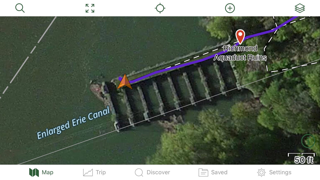 So, I had to decide … call it a day real early and camp nearby with the threat of mosquito swarms … 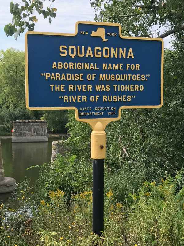 … or continue on and hope to fall upon a decent camp site a bit down the trail. No acceptable stealth camp options came up between Montezuma and Weedsport, so … back on the canal trail. The trail followed the old "Enlarged" canal route, but not the "modern" (NYS Barge) canal, so the popular option of camping at any locks was not to be. More things to see along the way … cool … but not a chance for any kind of quiet site to pitch a tent.
I reached Route 173 in Amboy at the west side of Syracuse, and by now it was obvious. I was NOT going to find a campsite anywhere in this area, and it's getting late in the day. I followed the "route" into downtown Syracuse and checked the smartphone for hotels. Of course, anything downtown was outta sight, price wise. Final option: get OUT of the city and find a cheap place. It's dark now, my lights are on, and I'm plodding through residential areas into Dewitt on the east side of the Syracuse metro area, and spot an Econolodge right off the route. I scored a cheap room, got a hot shower after a surprisingly warm and sticky day, and grabbed a sandwich at the C-Store next door. Checked the GPS: 103 miles. A Slow Day, huh? So, Day One of my easy tour didn't go as planned, and neither did much of the rest of the tour, but it turned out to be a Really Great Time™ anyway. And I scored my "Century #22" for the year. Fully loaded, in fact. To read about the rest of the adventure … including the "High Point", visit my journal "The Erie Canal and Bonus Points" on CrazyGuyOnABike.com. Ending my last post, I pondered " … do I stop at 20?". Well, the promise of nice weather sucked me in again, and I scoured the bike club map list for something new and interesting, yet starting close to home. Now, I've ridden nearly every mapped century our club has at some point over the years, but one popped up that I had actually never ridden and completely forgotten about. And as the Maps Director at the time, I even drew the map for it way back in 2004! The Frontier Century got it's name not for visiting new frontiers, but rather for it's start location: Frontier Field, Rochester's pro baseball stadium. That's plenty close enough to home and with a manageable distance of 103 miles. Yet another sunrise start time (6:30am and getting later every day) and I was headed off toward Canandaigua. And yes, I stopped once more at Dalai Java for refueling. I had a cup of coffee and a bowl of cereal at home, and was proud of my discipline to skip the chocolate chip muffin this early in the ride this time, but a strong red-eye served as my rocket fuel for the next few miles. Just at the edge of town, I remembered seeing an unknown trail on an earlier ride, splitting off alongside the 5&20 highway overpass. Route deviation #1. I had to, ya know.  Very shortly, it became clear why the trail was named the "Switchback Trail". Not sure why it exists, or how it got there, but it's clearly not intended as a skinny-tire bike route regardless how short. The surface was loose crud, kinda like ground up and discarded asphalt at the beginning in the area of the switchbacks. But as it leveled out closer to the top, the surface improved and was pleasantly shaded from the sun. Where it popped out left me off route and I accepted that the day's ride would not meticulously follow, but only "sorta" run like the planned route.  With a couple more variations, I got to the cool part: Goff Road. It's "a bit of a climb" over the ridge separating Canandaigua Lake from the Bristol Valley, but the payback on the west side is too much fun to miss. By the time I arrived at Bristol Center, I knew it might be wise to refuel since the next possible stop would be Honeoye Falls, many miles and hills later. A coke and a slice of pizza at the Dandy C-store was enough to carry me through the rolling cow-country … 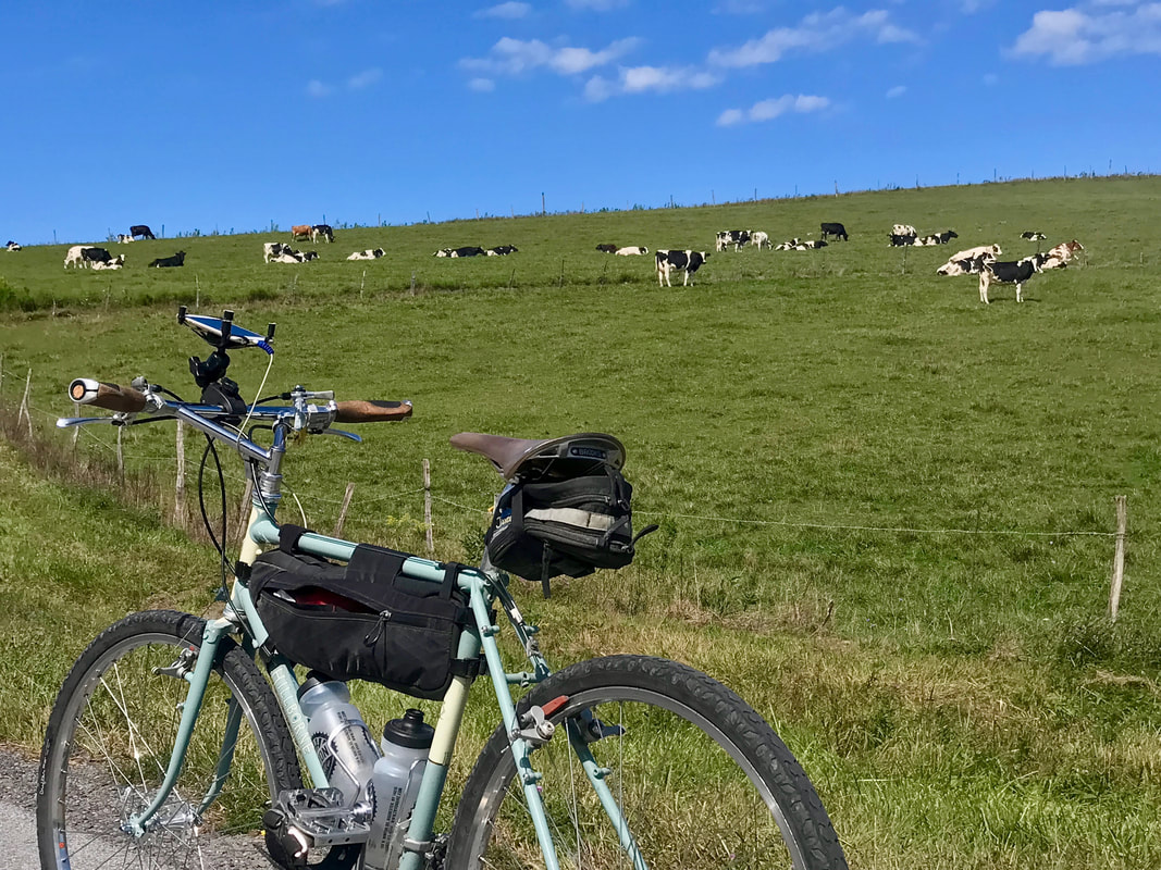 … and all the way through Honeoye Falls and beyond to Avon where I had to stop for a coke. Nice weather so far today and I've only had 1/2 of the first water bottle, but it's warming up and I know I'll start chugging it soon. Refreshed, I grabbed the increasing southeast tailwinds and flew down to the Genesee River and up the hill to West River Road, on the way to Scottsville. But heading up that way, I diverted temporarily once again. I finally discovered the access trail off River Road to Wadsworth Junction and had to go off route … and off-road … to check it out. For those unfamiliar, Wadsworth Junction is where the Genesee Valley Greenway and the Lehigh Valley Trails intersect on the west side of the Genesee River next to the old railroad bridge. And it was here that I had an epiphany! A few centuries ago (rides, not time) I "got detoured" off my planned ride up the Greenway by a Trail Closed sign on Route 5. It was not apparent why the trail was closed, but I believe I discovered why today. 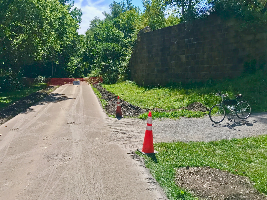 It seems some serious trail surface improvements are underway on the Greenway and it appears that the section(s?) between Canawagus Park in Scottsville and Route 5 are getting some attention. Looking like a firm base is getting built up, I suspect that the smooth and solid stone-dust treatment is on it's way! So much for the old rooty bumps and low spots that made fat-bikes the best choice for these sections. I'll look into it, but perhaps this time next year, we'll be cruising' here on not-so-fattie wheels. Fingers Crossed! I flagged Karen and told her I was headed up the Greenway toward the city, so she saddled up and headed south in time to intercept me at Genesee Valley Park. I told her I was on a mission, with a "destination". Despite my alternates, I "just had to" finish the ride properly in honor of the route's name. 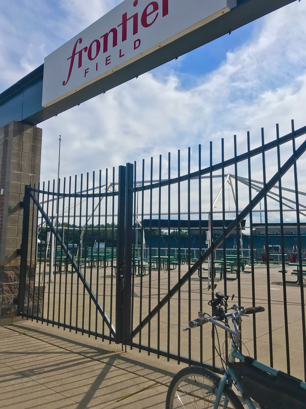 Wrapped it up with 105 miles in well under ten hours even with the delays and detours and only one slice of pizza for food en route. But DAMN … that red-eye carried me pretty far! 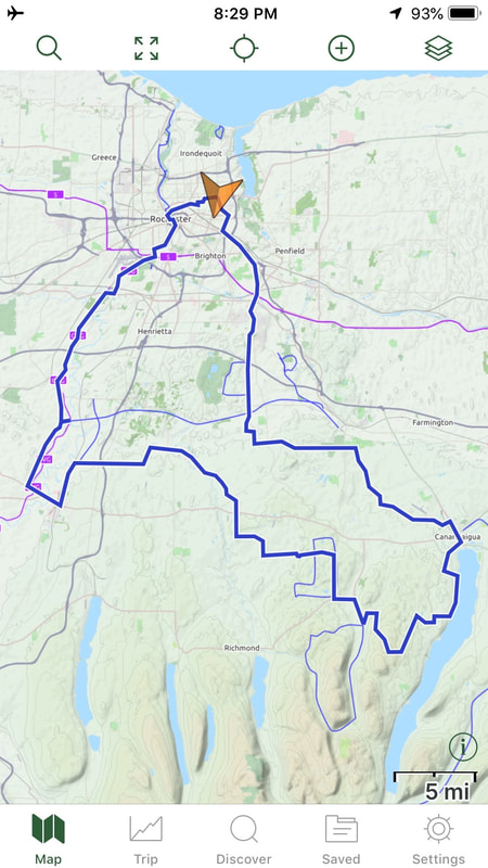 So, I've doubled the number of Century rides I originally planned to do for 2020. I figured ten was plenty, but what the heck … Covid and all. And like many others, I had a "planned" route for today, but strayed from it again. No rules. Green line (102 miles) was the plan; red line (116 miles) was the reality. 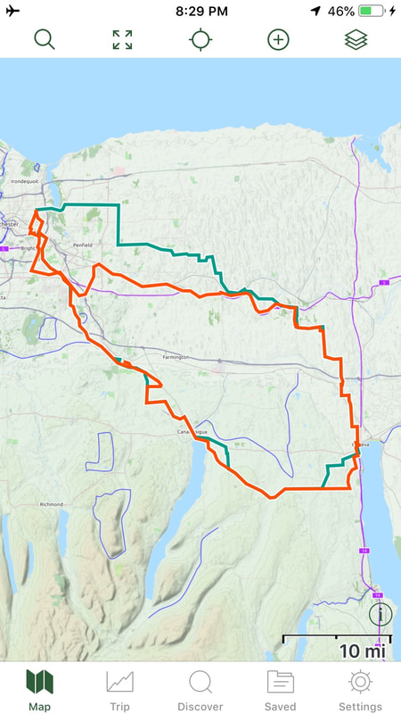 It started late again … 7:00am … and I got through the city and Pittsford before traffic picked up. I've come to rely on getting in and out of the city on the multitude of trails we have around here, and the Auburn Trail through Fishers and Victor has had a number of improvements in recent times that made this morning's escape a real joy. 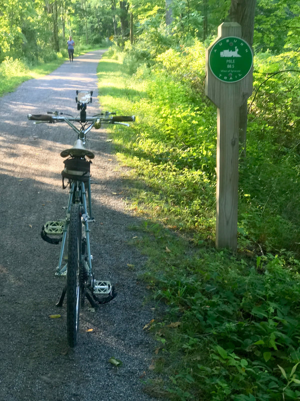 That got me all the way out to Route 332 leading to Canandaigua, but I backtracked a bit to avoid the 4-laner, and snuck into Canandaigua past the airport. Of course, no visit to Canandaigua is complete without a stop at Dalai Java for a coffee and an extra treat of a chocolate chip muffin today. That's the rocket fuel I needed. I headed to the lake where I was recognized by a lady who had seen me way outside town. 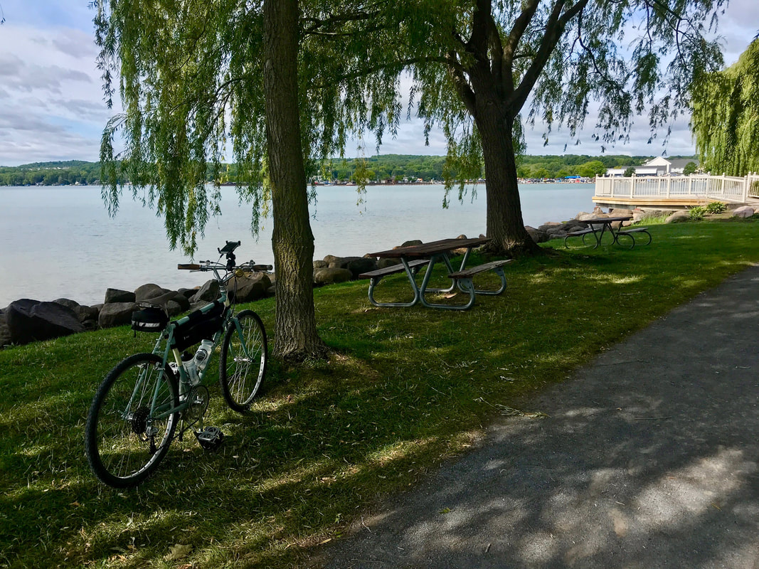 She was surprised to see how far I had travelled, but was really shocked by hearing I rode from Rochester, and especially where I was headed. I often get tickled by the response we get from non-cyclists when they hear about what is commonplace among us. Admiration when they hear of a 30 mile ride, incredulous when we mention a century, and thinking we need professional help if we wax on about cross-county tours. Always worth a giggle. I headed up the hill toward Gorham and discovered that CR18 had been freshly paved nearly the whole way, and with a slight tailwind, it was glorious! (Once over the hilltop, anyway.) Not much happening in Gorham so no stop there. But I did stop and wander around a bit in Geneva. First stop was on Linden Street to get a shot of a gorgeous wall mural … 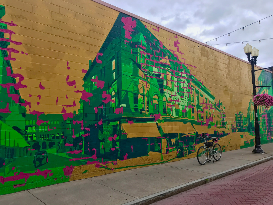 … another stop at the lake shore, of course, but then a surprise stop on Genesee Street where I discovered an old train station for the Lehigh Valley. And I could be wrong, but it looks occupied! At least there are two mailboxes at the driveway. Very cool. I can see myself getting to bed late after scouring the interwebs trying to find out what's up with that. 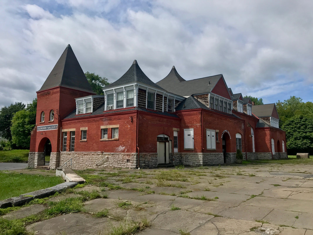 Leaving Geneva and heading north to Newark had me zig-zagging a series of quiet country farm roads till reaching the Erie Canal. Needed a stop, only my second for the day, and grabbed a coke, salty chips, and extracted a banana from my bag before it got smooshed too bad. By this time, I knew I'd be over the planned 102 miles by the time I got home and it would be closer to "rush hour", so I just decided to snag the canal trail back to the city. 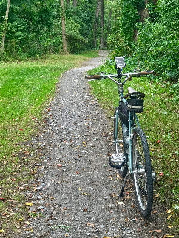 Just past the Dog Days of Summer, today offered gentle (if any) winds, mild temps, not too much sun, and very little "climbing" of note and very little sweating, so today qualifies as just a lazy sleepy bike day.
Hmmm …. do I stop at 20? I wanted some hills on the next big one, but I wanted a bunch of miles to get me over the 6500 mile mark. And as the summer begins to wane, I'm losing my early morning daylight, leading to later start times. With sunrise just before 6:30am, my choices for long days in the saddle are either be late for dinner (no way!) or take the Frankenbike. I suppose the third choice would be to try to ride hard and fast but, well, that ain't me. Getting in a century while fighting headwinds the last 30 miles is plenty tough enough. I took a straight shot down to Livonia via Clover Street / Route 65 and Poplar Hill Road. My reward came in the form of shiny smooth pavement on Big Tree Road leading out of Livonia headed toward Honeoye. One of my favorite roads, Big Tree is particularly fun when you head east bound with solid Northwest tailwinds! At mile 38, I stopped in Honeoye for a slice of pizza and a coke just before the climb into the Bristol Hills via Honeoye (US20A) and Bristol Roads (CR21). This route, from Honeoye through Bristol Center and into Canandaigua on CR32 always triggers the Wayback Machine for me, as it's part of the Gear '80 Hilly Century. Our club hosted the Great Eastern Rally in 1980 (and again in 1993) based in Geneseo and at the ripe age of 24, I led the Hilly on a day that rained most of the day. Standing in the rain at the top of the hill just east of Bristol Center and looking at the next hill to the west was "intimidating". I'll never forget it. My next stop at mile 53 was in Canandaigua for a coffee at Dalai Java. By this point, the hills of the ride are done and heading north leads to gently rolling terrain of the Wayne County drumlins. No need to stop in Shortsville, no need to stop in Newark, and no need to stop in Sodus as it was a cool day and I had plenty of water on board. But when I got to Lake Road and turned east into the headwinds, I REALLY craved for a stop, but the next place was Pultneyville. At mile 92 in Pultneyville, I took a break. Ordered a Taco Wrap. And a coke. And I sat looking at my progress. By this time, my overall average speed had dropped to 14.9. I was facing another 25 miles of headwind, at the least. Not expecting a winning performance today, I rested and ate, and killed 30 minutes surrendering to the moment. I packed 1/2 of my wrap in the camelback, and rolled on. Although it started slowly, my speed began to pick up as the wind began to soften just a bit. Just a bit, but enough. I pulled into the driveway and stopped the clock. 121 miles in 9:48. Shocked. I bested our "typical average" of 10mph by better than two hours. Saved Century #19 to the log, then early to bed. 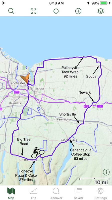 |

In the Finger Lakes

Slow Rides
Archives
October 2024
|
 RSS Feed