|
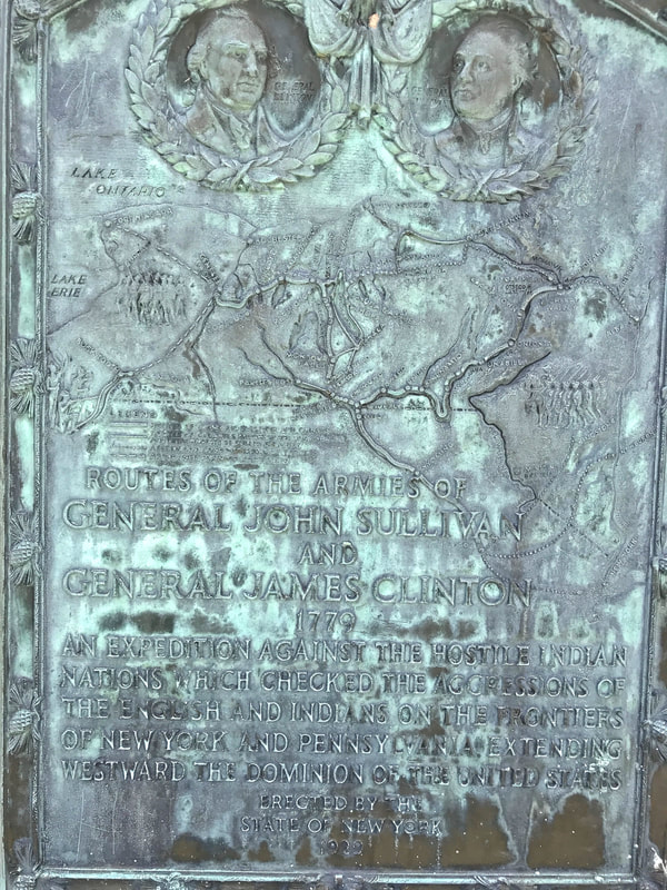
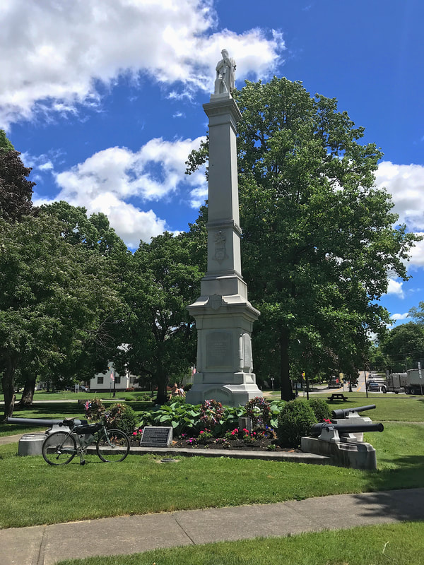
I hacked out a plan to visit the four smaller Finger Lakes due south of Rochester: Honeoye, Canadice, Hemlock and Conesus. I did manage to visit each one on today's ride, but not in the way I had planned. My "plan" was based on the local Rochester weather I saw that promised low 70's and little to no chance of rain, although a bit windy. What I didn't plan for was the weather expected for down south! Heading out, I saw a bit of sprinkles getting south of Pittsford, but it passed quickly. I wish the wind had as well, but I'll take it. As usual, it was a bit of a struggle getting into the hills with significant southwest winds, but as the days are long, I knew I had time to add-on a bit of extra hills approaching Honeoye in the early part of the ride. From Honeoye, the fun really started. Up Jersey Hill Road. UP CR37. Down Burch Hill Road. Up Purcell Hill Road. Up Lawrence Hill Road. Down Old Bald Hill Road. (42.7mph!) Up Johnson Hill Road. Up Canadice Lake Road. Down Marvin Hill Road. Whew! Let's stop for a coke break in Springwater and stand in the rain. Yeah … I'm gettin' rained on since turning onto Canadice Lake Road … PLUS getting blasted by the winds. I ask the young lady at the Dollar General checkout: "Is it supposed to rain today?" "Yes" OK … let's think about this. My "plan" was to climb out of Springwater on Marrowback Road, a 6 mile climb on a dirt road. Plus another three miles to Wester's Country store in Conesus, my first chance at shelter if the rain and wind gets dangerous. Never mind the mud on Marrowback. So, thinking like an adult (which I'm not too skilled at), I decide to skip Marrowback … the whole REASON for coming down here … and head straight up NY15A toward Hemlock where I could quickly find shelter if necessary. Five miles later, I'm on the top of the hill and sure enough, the sun pops out! #@%^*! I decide in Hemlock, I can take Rix Hill Road westbound and reconnect with my planned track, but the bridge over the outlet is under reconstruction. So, I stop at the Hemlock Lake Park to pause and figure out a plan. Nice park, but there's a bronze plaque at the entrance that catches my eye. It's a historical plaque showing the routes of the Sullivan and Clinton expeditions going through here in 1779, "… against the Hostile Indian Nations …" and "extending westward the domino of the United States." Yeah, I'd bet the native Indian Nations of our area were very hostile to white man coming in, spreading disease, raping their women, destroying their crops and murdering everyone in their quest to colonize the new world. Yeah, I'd be a bit "hostile" too. Outta there via Adams Road, I eventually reconnect with my route and soon after arrive in Avon. Now, I've ridden through Avon countless times but I admit I've only "noticed" a big statue/memorial in the village's park/traffic circle, but I stopped for a break to eat my PB&J, and discovered yet another historical piece. The huge monument (45' tall) in the center, which was installed/completed in the late 1800's, is a dedication (with names) to the local Union Civil War soldiers who fought for the end of slavery. Happy to see that, I still left town confused how our leaders (and followers) justified killing one group but fought to save others from slavery. What can explain the confusing morality, or if any exists at all?
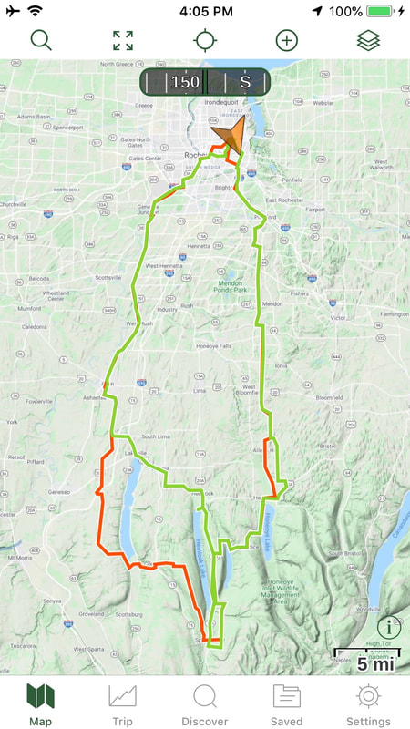
Back up into the city, I wrap up century #10 with 103 miles and one helluva tan. The red line in the image below was the plan, and the green line was the actual. And now … What next?
0 Comments
Your comment will be posted after it is approved.
Leave a Reply. |
Archives
October 2024
|


 RSS Feed

