|
Back in June, I wrote about my attempt to ride Marrowback Road (Four Lakes Century) that got derailed by what appeared to be imminent storms, yet never materialized. So I'm at it again. Different route but same objective … get down to Springwater and head north (UP) Marrowback Road. But this time, I'm-a-gonna-do-it no matter what. I don't care what the weather might bring, 'cause I'm takin' the monster bike that can handle all the mud and crap Marrowback could toss at it. My hot little Co-Motion Pangea with the sealed Pinion gearbox and belt drive means the only weakness in the plan would be ME. And since I'm planning to get dirty, why not plan a dirty route? Since the dirty sections will eat up daylight, I head out early and beeline south toward the hills. The first one, climbing up to H.H.Spencer Recreation Area took a while … about an hour from Honeoye to the park, about seven miles, all UP. 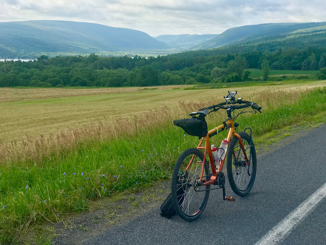 Yeah, I'm not too quick uphill and against the wind, but at least this time I didn't have to climb Cratsley Hill or even Jersey Hill Roads. I'd still be out there. When I got to the dirt road, it was time to lower tire pressures for comfort and traction. First stop of the day at 38 miles out, I pulled into the park and ate my PB&J before heading on up past "the equipment" on Canadice HILL Road. 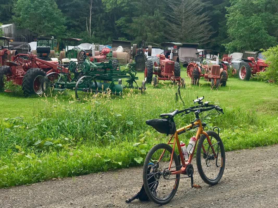 Dirt roads are even more fun when they go down, like Reynolds Gull Road which connected me to Canadice Road. Not be confused with Canadice LAKE Road nearby. Clear as mud, right? And from there, I got to bomb down East Street to Springwater. Oh, the memories of THAT street! So now, it's across the valley and the turn up Marrowback. 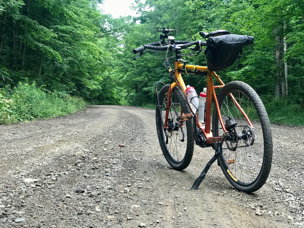 Nice Day! No Rain! Getting a bit hot and a bit sticky humid now, but the rocks, gravel and dirt and steep grade are no match for the super-low gearing and wide squishy tires. But I'm no match for the horrendous biting flies that swarm my head and make my shadow on the ground look like I'm in an '80's big hair metal band. Yeah, think Twisted Sister. Twisted is right … I was going nuts riding all-too-slowly uphill, most of the time with only one hand on the bars while the other was helplessly and hopelessly swatting at the little bastards. I couldn't get to the top soon enough. But eventually, I made it to the top with enough blood remaining to finish the ride. Note to self … only ride UP Marrowback when it's snowing. A stop a Wester's Country Store in Conesus (3rd time this season) for pizza and coke, and it's down Sliker Hill to East Swamp Road (more dirt), to Guiltner Road (more dirt), across NY256 onto Bath Road (more dirt) and … dammit! Those *@#%%!! flies must have followed me! I'm getting swarmed again! I try to pick up the pace to no avail and get to the planned turn UP Barber Hill (dirt) Road. UP as in a seriously wicked steep seasonal use road. I remember coming DOWN that hill once on the motorcycle with full knobbies and dragging the rear as I slid down. Any plans on climbing that thing with the flies chasing me the whole way are scrapped. I jam it on down Bath Road, flies in hot pursuit, till I reach the zig-zag in the road at Bean Hill where it turns to pavement and I can really pick it up and get away for good. Now, I'm off route getting into Groveland but Groveland Station Road will intercept my planned route north toward Mount Morris. All good. As I pass by the old c-store/cafe that closed years ago, I see a signboard for $4.00 Milkshakes! Cool!!! Turns out, the store now is open as an ice cream shop! Open Tuesdays thru Sundays at 1pm. It's 12:30pm It's Monday. *@#%%!! I grab a coke in Mount Morris before hopping on the Genesee Valley Greenway. Time to slow down and relax for the long haul (dirt) back to Rochester. I see a hiker ahead on the trail who is bending over with his face in the bushes and I'm wondering: 1: WTF is he doing? 2: Should I call out and alert him to my presence? 3: Should I blast on by hoping he won't spin around in time with his machete? 4: Am I getting dehydrated and delirious now? Alas, he hears me and sees me coming and he has a treat for me … he points out the black raspberries he's been picking! 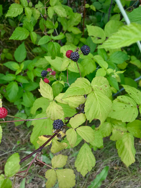 Too nice! After a couple handfuls, I'm on my way. I get to a road crossing with one of the yellow gates across the trail keeping cars out, and stop to remember days long ago. Days when the Greenway was just a glimmer in trail users eyes. Days when gangs of us bought weed whackers and chain saws to clear trail and when some of us experienced poison ivy in the worst way. Days when me, and Russ Reeves, and Jack Kerson and Al Oberst and fondly, Fran Gotsik and many others formed the Friends of the Genesee Valley Greenway and we had events and meetings all over the Genesee Valley and made a website and newsletters and busted our asses in so many ways to get the state's and Governor Pataki's attention (and MONEY) and made the Greenway a reality and it eventually became an honest to goodness New York State Park! 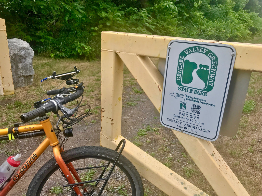 If I could make a list of the few things that I got into in life that had some kind of lasting impact that I truly valued, this would be right there near or at the top. More miles of trail. Sometimes across open fields and sometimes in a tunnel of green. It's all good. 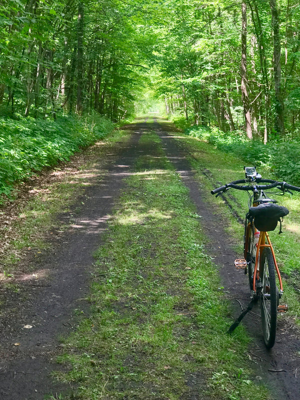 As I cross NY5, I see a barrier ahead. The trail has a closure for unknown reasons and the sign points to a detour that uses another old railroad right-of-way and ends up carrying me across the Genny … 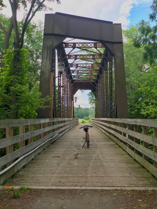 … and into Avon. The day is getting late, and after one more stop for a coke and potato chips, I opt to take East River Road (aka: Rochester Street) out of Avon, pump up my tires and head back to the city. 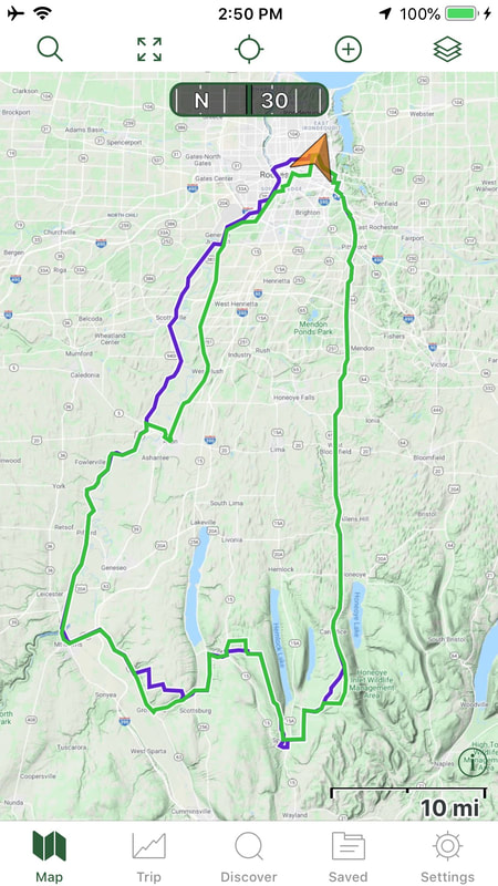 This was one long hard day. 114 miles, (Century #15!) much of it dirt, and somewhat following the plan. Blue lines are the plan, but green was the actual. It worked well, and I slept soundly.
2 Comments
DAVID Larson
7/17/2020 06:57:34 am
Well, maybe on a motorcycle :-) .....hate being swarmed by things that bite and not having the option of speeding up to get away.
Brian Managan
7/17/2020 10:34:54 am
We knew a guy in the club who wore a full coverage motorcycle helmet while (recumbent) bicycling. You might have known him too. Maybe he was onto something! ;-) Your comment will be posted after it is approved.
Leave a Reply. |

In the Finger Lakes

Slow Rides
Archives
December 2025
|
 RSS Feed