|
You can tell when the weather gets nice. I have trouble sitting down at the Mac to write when all I want is a hot shower and early to bed. My last post (1/2 a month ago) mentioned two centuries, but this post only has one. A week ago, I set off to “paint some roads”. Yeah. In the RideWithGPS website and app (premium account?), you can display a heat map of roads you’ve recorded rides on. I only started really using RWGPS to log my miles since late 2020, so most of what I’ve covered over the years hasn’t been captured. But it appears that 2021 was pretty busy and I managed to cover much of northwest Wayne county, but there are still roads to be savored! 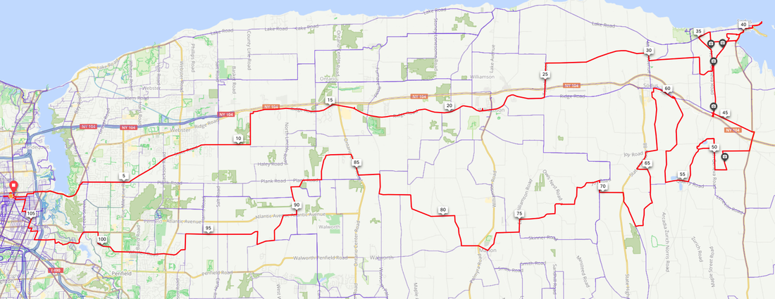 Blue lines are where I’ve been. Red line is the day’s ride. And a nice day it was! A cool start, but it warmed up nicely by the time I stopped for a snack in Sodus Point. Bonus points for discovering a rail-trail between Sodus Point and Route 104. Scored 108 miles on that one. Another super riding day came when I was leading the “Wayne & Brian’s Ride”. It’s another bike club “Adventure” ride, and yes, there was a buddy, many moons ago, who once called me up and said “Let’s take a f@#*-off day and go ride the hills!” And did he ever find some hills! That was Wayne and we HAD to save that as a bike club ride. And this year … 28 YEARS later … who shows up for the ride but none other than Wayne himself! 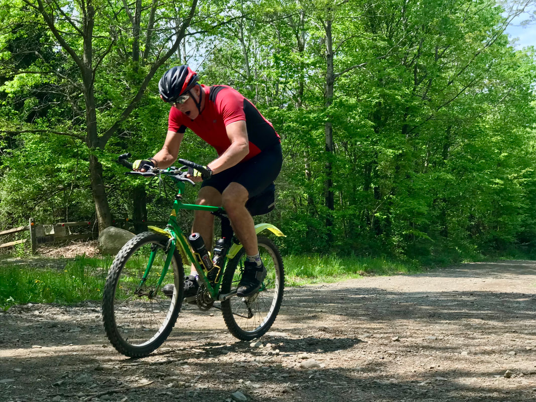 And he even rode the same bike! May started a bit slowly, weather wise, and toward the middle of the month, I was beginning to wonder if I’d end up with fewer miles in May than April. But the last two weeks shaped up nicely, I’ve been getting out on longer rides most days, and I ended up beating my goal of 4000 miles by the end of May, by 220 miles. Terrific! And the ride that really put me over the top was yet another old, old, old bike club route: Todd’s Turns. With Todd leading of course, we did that ride on Memorial Day in the heat. Most everyone who showed up at the start had announced that they would take a cut to avoid the afternoon heat, except for that one guy. I had no time commitments and brought two bottles and a hydration pack, so I was OK to give it a shot. The full route of Todd’s Turns is 76 miles and the best part of it is Fowlerville Road, with it’s long gentle downhill to the east. Combined with the day’s steady tailwinds, I was in Avon in no time! LOVE that road. And I felt good having done a “Good Deed” that day, with the help of another rider, Jay. 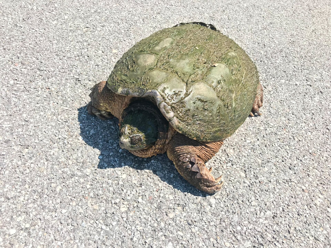 Mean, nasty, typical snapper. We came upon a giant snapping turtle on the road and I HATE seeing critters getting mooshed by cars. Jay expressed a certain “dislike” for snappers, thinking maybe he’s right where he oughta be. But I insisted on saving the big guy, so Jay and I grabbed a couple big sticks and eventually convinced the big green guy (well … we kinda dragged his ass off the road … a good 30-40 lbs worth) to return to the bushes. And that was the big excitement for the day. Shortly after, I peeled off from the group to ride on with the full route. It was hot, and the wind started shifting by the time I got back. I knocked off the 76 miles in just under 6 hours with only two stops for fluids and was pretty excited to fire up the air conditioning in the car for the drive home! So May turned out just fine. Stats below. 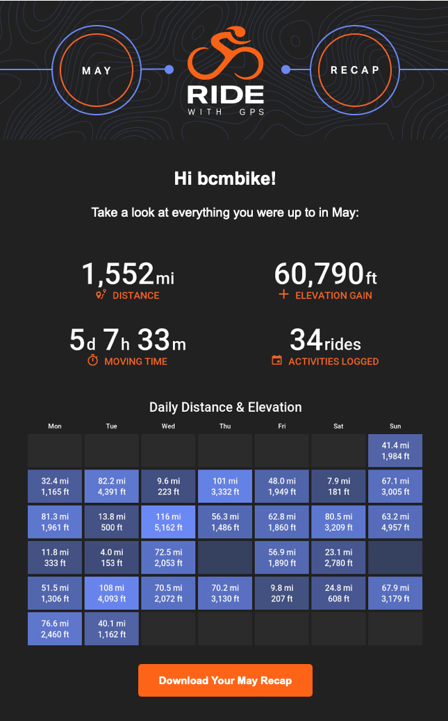
0 Comments
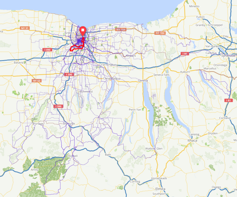
Being retired and doing little more than riding bikes, some things happen. My face gets the raccoon look from hiding behind sunglasses during endless unprotected hours of sunshine and the rest of my (exposed anyway) skin turns brown after the “Season’s First Burn” sloughs (molting?) off. And dead skin isn’t the only thing falling off. Last fall’s post-surgery “Surge-Weight” (coined by Steve R.) also falls off, and this year, quite precipitously. Mission Accomplished. 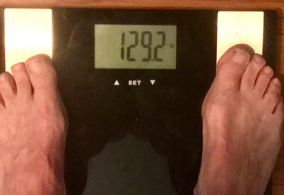 Down from post-surge of 150lbs in January I haven’t planned on any big mile goals for the year, but an aggressive start for the year has me logging 500 more miles this year (3620 miles to date) than the same time in 2020 when I hit 11,000 miles for the year. So, when a gloomy day like today comes around, I don’t feel like I’m cheating myself by leaving the bike hanging on a hook today. To catch up … the last blog post talks of this year’s second century (a 100+ mile ride). I can report two more since then. May 5th was #3 at 101 miles on my Rivendell Sam Hillborne “country bike” as the builder (Grant Petersen) calls it. 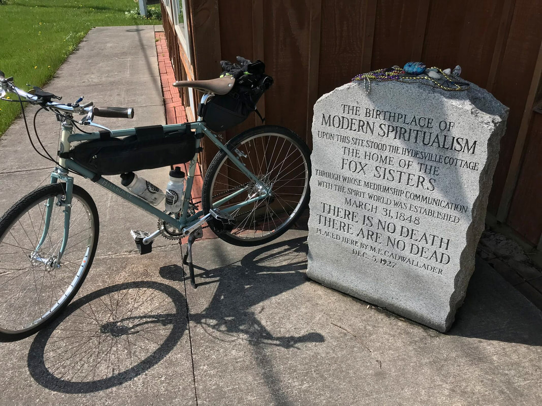 Sammy Visits the Fox Sisters of Hydesville That’s his response to the bike industry’s marketing hype of calling something a “Gravel” bike vs. “All-Road” bike or whatever else they come up with. Bottom line, a bike is a bike and where you can take it often depends more on attitude than equipment. If the bike is comfortable, well fit and adjusted, just get it on and go. Sammy is responsible for a respectable chunk of my road and rail-trail miles this year. I credit the super smooth ride as the reason this bike seems to be the default choice for many rides, even an occasional century. It’s not my “fast bike” by any means, but it’s a sweetheart. On a recent club ride, I was advised by a fellow member that I’d be “Really Fast” at my weight if only my bike didn’t weigh twice as much as his. He groaned when he picked up my bike (bags filled with stuff) for comparison. I’m not sure how a light bike can make up for carrying an extra 30 pounds around the midsection, but I noted how the rider finished the 35 mile version of the route in about the same time I did the 50 miler. Whatever. So on this particular day with full sunshine, low winds and no hurry to get home, Me & Sammy went noodling around looking for back roads in Wayne County that I have not ridden. Turns out, I gotta go waaaay out to find any roads I haven’t visited. The Ride With GPS app (and website) enables a heat map showing roads you have recorded riding on. I only started using RWGPS for tracking my rides very late in 2020, so a LOT of what I have ridden isn’t shown. 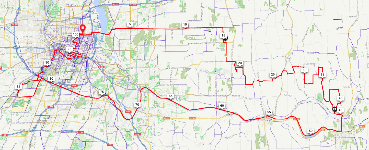 Red line is the ride. Blue lines are where I’ve been since late 2020 May 11th with 116 miles was #4. This ride was a modification of an old RBC classic: Map #84, The Old Hilly Century, created in 1972 by Dick Burns, a fixture of the club for decades. Back in those days when 5-speed freewheels were standard and triple chainring cranks were considered “exotic” , the Old Hilly was a real test of endurance, and unchallenged till the same man developed the Gear ’80 Hilly (yet another fave!). Not considered difficult in modern times due to vastly improved bike technology, the Old Hilly is still a sweet day ride. So, on a gorgeous sunny day, I took off on old bike, the FrankenTrek, and headed for C-Daigua. 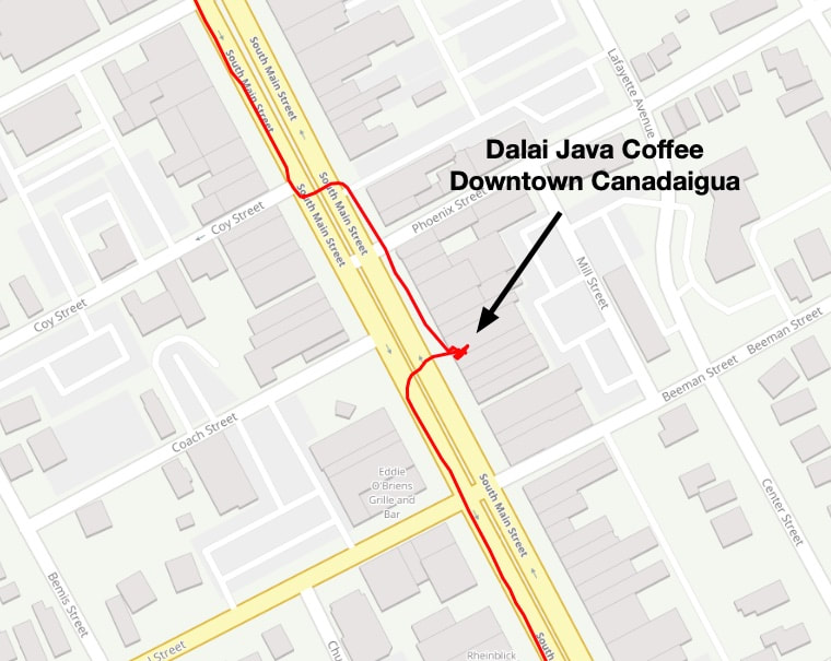 Stop #1: Coffee and a muffin (I know, I know … I’m supposed to stay away from caffeine since it isn’t compatible with my RBD, but how do I legitimately wash down a cranberry - orange muffin without it?) The ride’s first hill of significance (CR18 out of C-Daigua is NOT) hit me at mile 47 with a short steep climb up Pierce Hill Road. Rarely an issue, but this time, the hill is getting milled for a new surface (soon I hope) and I find my fast bike with skinny tires can double as a full-body vibrating massage.  No Nice Words to Say Here! I stopped again in Middlesex to grab a chocolate milk (MORE caffeine Brian, really?) mostly to check that the store is still in business … ya never know anymore. Cruised down 245 toward Naples but turned down Parrish Cross Road before Naples to go check on the trail situation for this weekend’s “Wayne and Brian’s Ride” (RBC#280). Looking good! So I end up on Route 21 a mile north of the turn UP County Road 12, so rather than backtrack, I decide to give Griesa Hill Road a shot. There’s a Road Closed sign at the bottom of the hill. Of course, that means no cars. But we cyclists sneak by/around/thru road construction zones all the time, so I disregard and start climbing. Now, the “fast bike” doesn’t have the super low gearing of some other steeds in the stable, so this is an out-of-the-saddle task of climbing almost 500’ elevation in just over a mile. And when I get to the top, I find the road really is CLOSED. 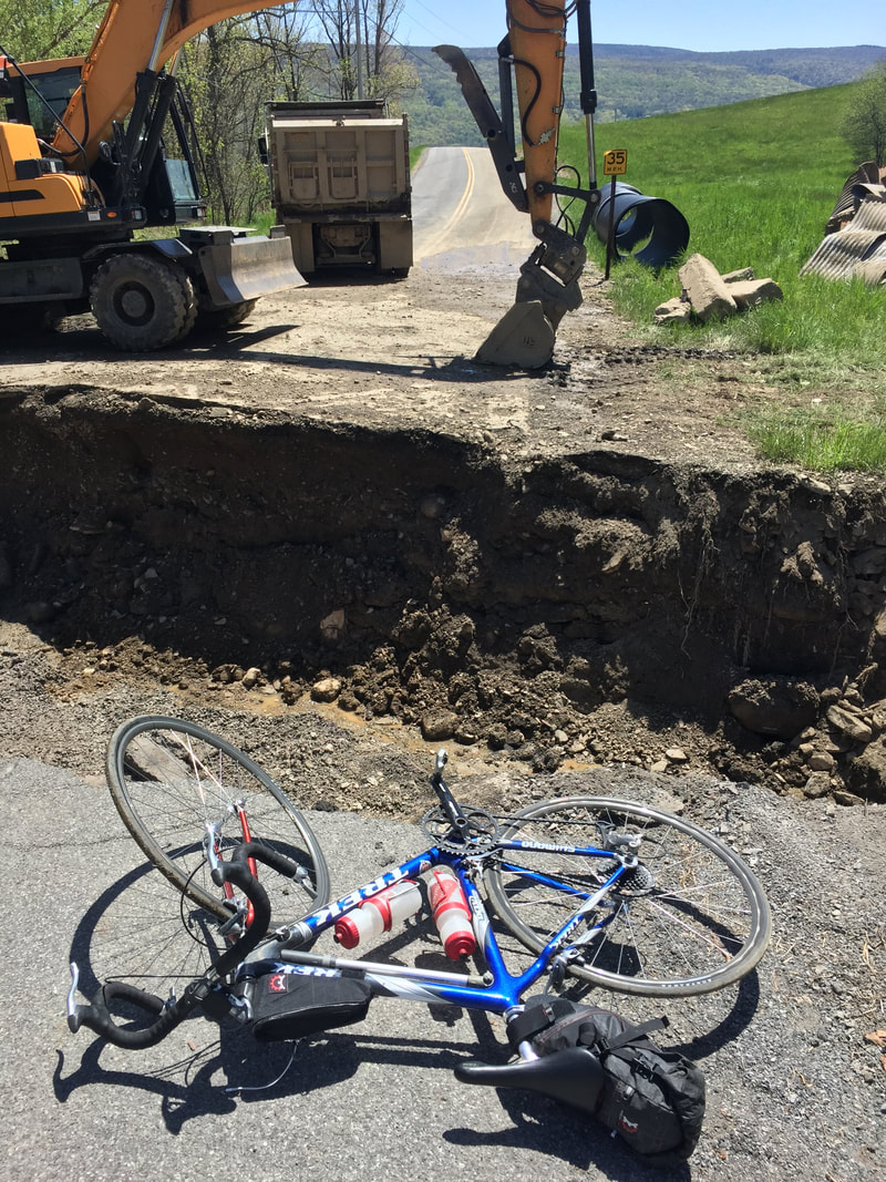 The ditch was harder than the climb I normally ride bikes with sneakers rather than clipless road shoes, so I wasn’t really prepared for THIS adventure since I’m on the road bike. I was able to scramble down into the ditch, toss the bike up to the road, and pull myself back up without crashing into the rocks. Back in the saddle, I paused for yet another peaceful moment at the overlook. 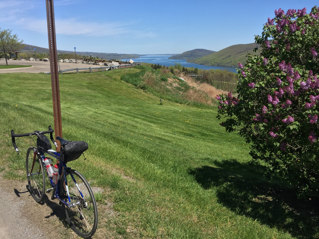 I never tire of this view over Canandaigua Lake Headed northbound, I had a sweet tailwind pushing me up Bristol Valley to Bristol Center where I stopped for a snack and a Coke (MORE CAFFEINE BRIAN ... REALLY?). Tailwinds were great and I was sure to be home in record time even with the stops. One last pit stop (stupid caffeine!) at the Victor Municipal Park, and I ended up at home in the sunshine with another caffeine fueled 116 miles. I even slept well. Shocking.  A Perfect Day It's beginning to look a lot like SUMMER!!!! b Unlike 2020, when I went bonkers about big miles (11,111) for the year, and about lots of centuries (25), I feel no compulsion to reach any particular goal for 2022. BUT … I have no plan to “take a year off” either. So Tuesday’s wonderful weather presented me with an opportunity to knock out a big ride in a “strategic” way. I had earlier plotted a route to the hills south of the city, but a last minute check of weather implied I’d have a nicer day by capitalizing on the increasing northwest winds in the afternoon. A westerly start in the morning promises a fast return, but “fast” means the right bike. Given how flat the terrain is to the west and north of the City, I decided to give Old Blue the honors. Dear Old Blue. So many miles, so many adventures, so many changes over the years, but still a sweetheart of a bike it has been and always will be. Smooth, silent and simple, Old Blue is my “2-speed”. It got me across the country twice in it’s current configuration, so it’s plenty good enough for a day out in the sun. Unlike Monday - Total Sunshine all day long Tuesday! Out the door at 7:15am and it’s already in the 50’s (F) with only gentle breezes. I pass through downtown and Genesee Valley Park on my way to the Erie Canalway Trail, and I pause on the Wally Bridge to watch the rowing teams. 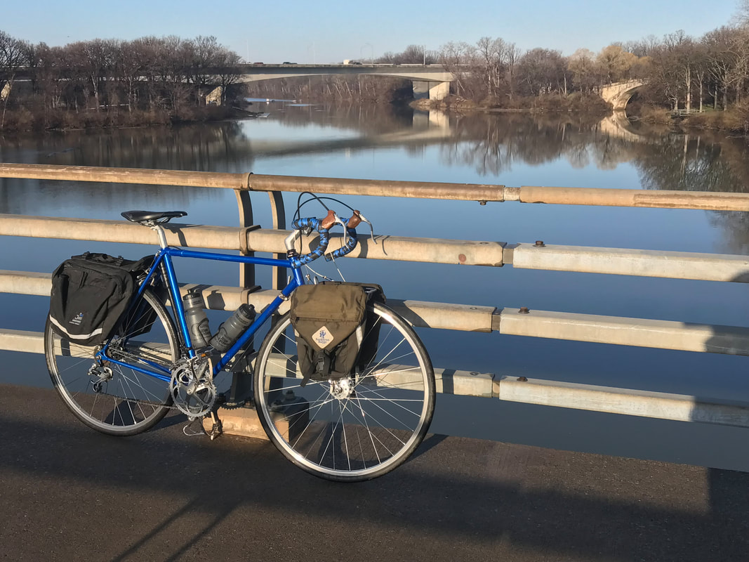 “The Plan” for the day was to take the trail all the way out to Albion but when the pavement ended at Long Pond Road, the softening of last night’s rain on the stone dust surface made for tough riding. I recalibrated my expectations for the day and took paved alternates to get to Albion. 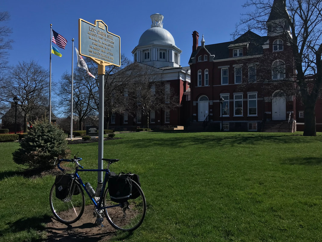 I chose not to stop in town, rather, I continued north on Route 98 to Route 104 when I scored a slice of Buffalo Chicken pizza and a chocolate milk. Yes, the “routine”. Grab food, take a leak, sit in the sun on the curb out front of the convenience store. I’m making a habit of determining the day’s ride based on a turn-around point at a Crosby’s c-store. I’m 47 miles in at this point. The food will be required. From Albion, it’s a straight fast shot to Oak Orchard, Point Breeze and Lake Ontario when I make the turn east toward the Parkway and the free ride begins. The afternoon tailwinds were picking up and I quickly started an internal debate about taking the time to flip-flop the rear wheel. This bike has a single cog on both sides of the symmetric rear wheel, so if I need a bigger or smaller gear, I can stop, pull the rear wheel, flip and re-chain it up into the dropouts and away we go. Right now I have a 22 tooth cog chained up, but I could use the 17 tooth for a higher faster gear. Would be GREAT not spinning out half the way home. Alas, I chose to work on my spin as best I could and accept that the return can only be “so fast” and not a bit faster. Fast enough though. Even with taking a pit stop and fuel break at Hamlin Beach State Park, I still pulled into the driveway earlier than planned. It never quite got warm enough to pull off the tights and wooly shirt, but with tailwinds and sunshine and miles of quiet and smooth Parkway to bring Old Blue back home, I think I’ll classify today as “Extra Special”. 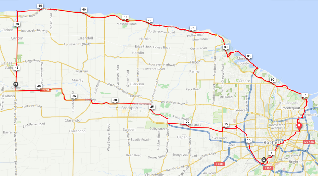 To date, I've knocked off TWO centuries and covered over 2000 miles for 2022. Looking like a great year.
The weather report suggested a “decent” day for a good ride. In the 40’s to 50’s, risking 60 degrees, partly cloudy (which means partly Sunny!) and gentle winds. Well, they’re ALWAYS gentle until it’s a headwind! I was itching to get out on a “fast bike” but when I realized conditions might be good to squeeze in a Century, that would mean carrying capacity for shedding clothing, so … the Rivendell got the honors. That also meant the day wouldn’t go as fast and I’d have to stay on task to be sure I got home well before rush hour … or DARK. I tried, I REALLY TRIED to get up at 6am when the alarm went off. But it was still dark, my cat was visiting me in bed and getting his scratches, and my weighted blanket is so warm and cozy … 7:30am comes around and I finally develop enough motivation (guilt) to get my ass up and out the door a bit after 8am. Now I’m pressed for time. I’ve been riding enough to guess how long it will take me to knock this one off. I plotted a 102 mile route the night before, figuring “I’ll do what I can … no promises.” Not 2 miles out the door and POP … my 4th, maybe 5th, flat in 2022. (Gravel King tires are a sweet ride, but man, they sure are delicate for a “gravel” tire.) On the noisy highway at rush hour, finding the puncture was a challenge but locating the offender still stuck in the tire helped locate the pin-prick in the tube. More pressed for time … not optimistic. Back up and running, I headed southeast toward Macedon on “roads” rather than my usual escape from town via trails … yeah … think I’ll avoid “gravel” today. My turn-around point was out past Clifton Springs … Toll Road out by the Newark Reservoir. The turn resulted in putting the headwind to my back and picking up the pace toward Canandaigua, where of course, I stop again at Dalai Java for rocket fuel … a Red-Eye and a cookie. I take my goodies to the little park across the street and have a look at the computer: My first stop, 58 miles in and it’s only 1:30. It’s decision time ... I could just head north to the Auburn Trail and head home via the shortest, most direct route. I’d be sure NOT to be late for dinner. Or, I could try to tough it out … Woolston Road being the “barrier” that could make or break the ride. And Me. Pain is temporary. Mileage Logs are Forever. Let’s Go.  Woolston made me feel it. The pace slowed down a bit after that, but I was relaxed knowing that I’d certainly knock this one off in time since I’d have a tailwind going home. Until I turned north. The wind had shifted from southeast to northwest. In what seemed like an eternity, I finally reached Mendon Ponds Park and pulled over to refill water bottles. I don’t drink like I should when it’s cool, I dehydrate quickly, and it doesn’t help that I left the house with less than a full bottle. So, a 5 minute stop to drink and refill was required. From Mendon Ponds, the cruise back into the city was pretty simple and putting a foot down in my driveway was a “Special Moment”. I’ve done countless Century rides over the years, but “The First One” each season is important. It tells me I ain’t dead yet! 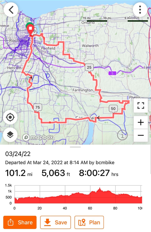 So, I hope to do several more centuries this season … maybe ten … with #10 on September 10th, 2022 being yet another “Very Special Ride”. Check it out! https://fundraise.michaeljfox.org/nepr-2022/bcmbike Peace! B With a somewhat stressful start to the year, this winter has been one where I’ve been MORE than anxious for spring arrive. I was OUT riding this winter as soon as I was cleared from the hernia surgery and I gotta say … I’m not sure if I’ve ever been happier getting back on the bike after an intermission. Weather be damned, I don’t let cold and snow and ice get in the way of a great ride. Studded fat bike tires are the enabling technology if ya like living around here. Yet, this winter has NOT been one of Rochester’s “most impressive”. According to the Golden Snowball, we are about 12 inches behind schedule: 83 vs the 95 inches average to date (3/23/22) and will likely yield this year’s award to Buffalo .... again. ;-) Mid-March, I needed to squeeze in one more (?) cool ride on possibly one of our last snowy days of the season. 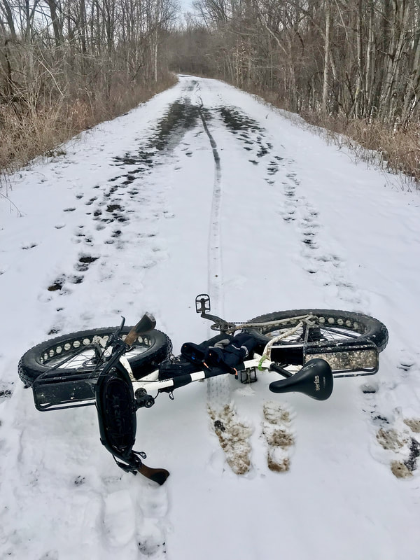 Lehigh Valley Trail - North Branch 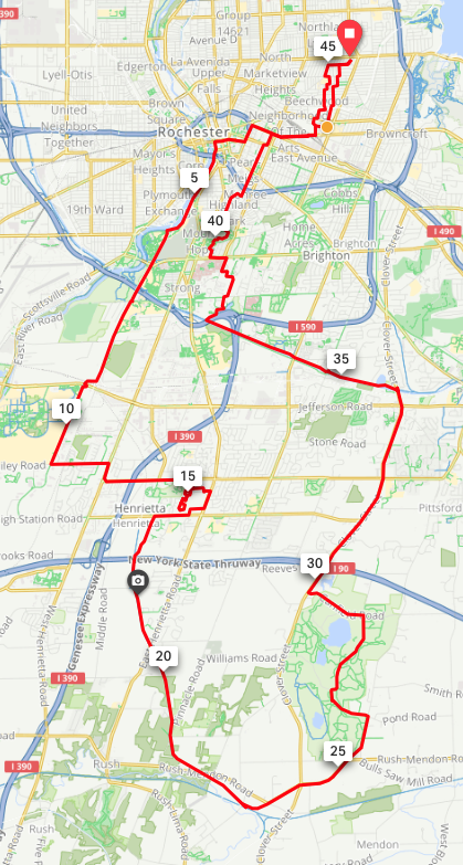 45 miles on a fattie takes a while. And just three days later - POP goes spring, sunshine, warm temps (hit 70!), and the first “longer” ride of the season. I was due for a coffee at Dalai Java in C-Daigua! 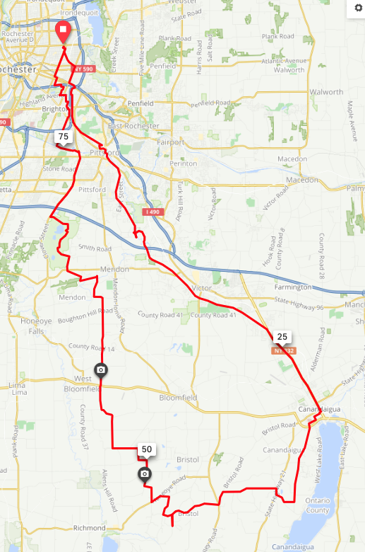 83 miles and Bristol Hills for Xtra Credit!  Always makes me think of Buckaroo Banzai.  How long before these are filled with milk production "byproducts"? Warmer weather and longer days also lure friends out on their bikes, so no surprise, Andy has a day free and we do the “Spring Spin” around the bay before the bay outlet crossing sadly slams shut for the season. (Note how that’s worded.) I have more free time than Andy and Karen, so I supplement the ride with an extra loop of my own. 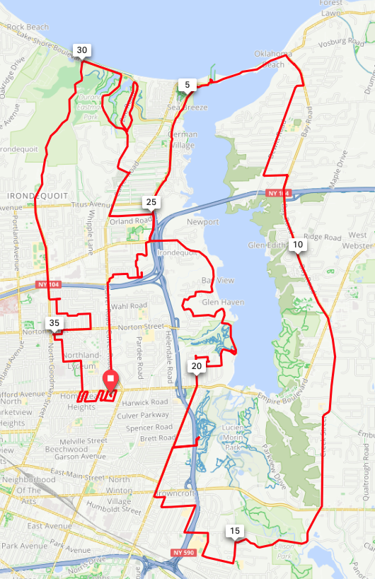 Today's Rorschach Test - What Do YOU see? A bit cooler the following day, I have some “research” to do. I’m excitedly watching the continuing upgrades to the Genesee Valley Greenway. New York Parks (formally known as “OPRHP” or “Office of Parks, Recreation, and Historic Reservation” - seriously?) resurfaced the Scottsburg to Avon section last year and are working on the Scottsburg - Ballantyne section this year. Step one involves establishing a track for the hard base that follows. 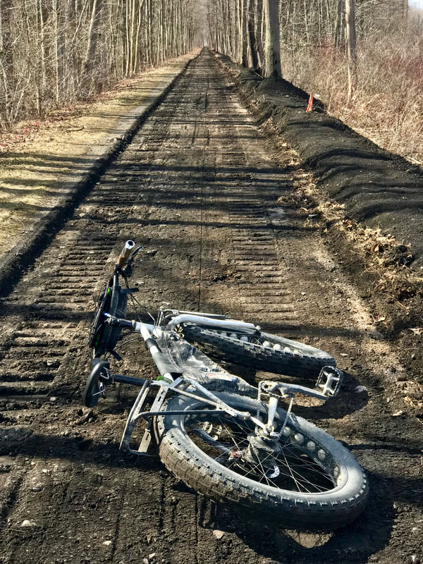 It was actually smoother BEFORE the dig. But, in time ... I met a worker at the Brooks road crossing who told me the expected completion should be around mid June. Hmmm … maybe in time for another southbound S24H … or longer? Who’s in? I had to jump off the trail at Brooks because the equipment was working south of there, so I took a paved bypass down to Scottsville. Sadly, I met an innocent victim of road rage (f***ing cars!) along the way, and moved him off the asphalt and into the grass. Ya know … I don’t see murdered animals on the side of bike trails. Just sayin’. 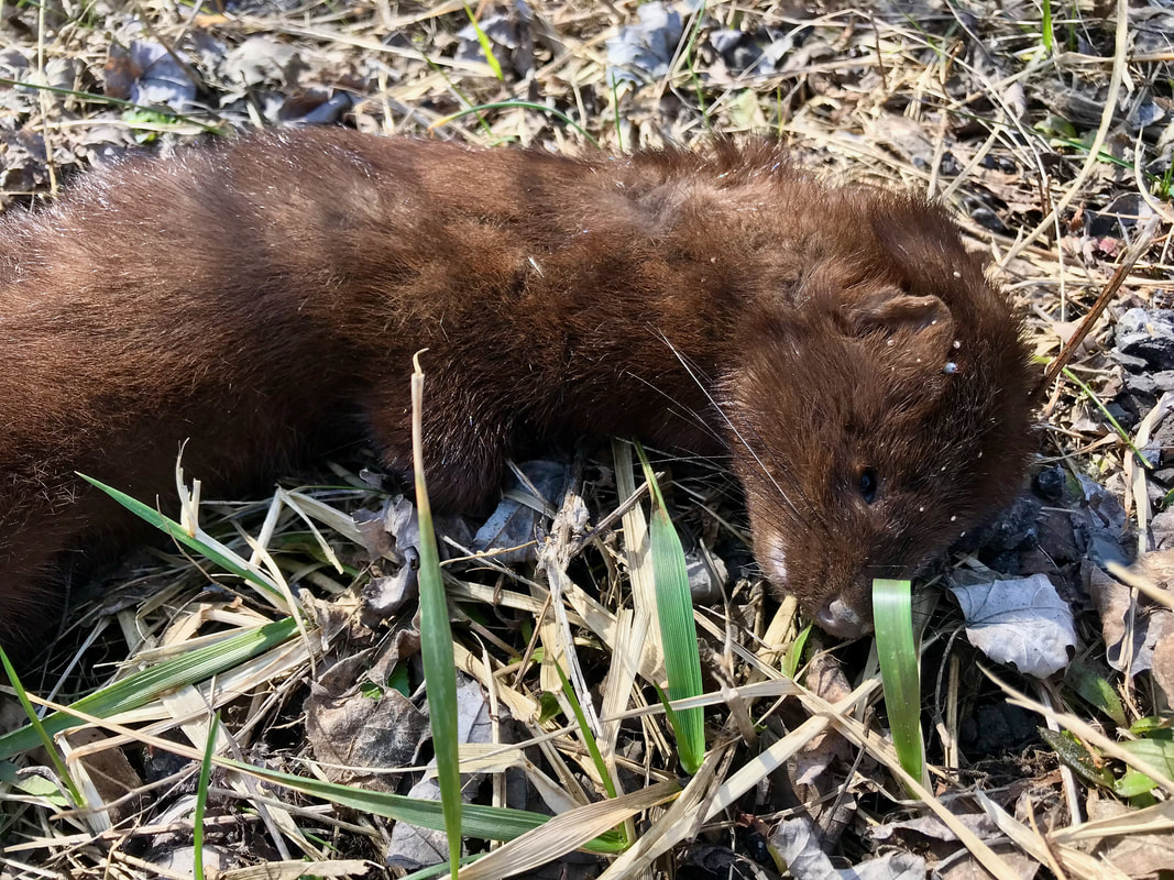 Poor Little Guy At Wadsworth Junction, I turn east across the Genny and lazily cruise the length of the Lehigh Valley Trail through Rush, Rochester Junction, and Mendon to the Auburn Trail connection. Along the way, I see a new development … a creative and natural solution to improve a hikers’ experience in low lying sections. 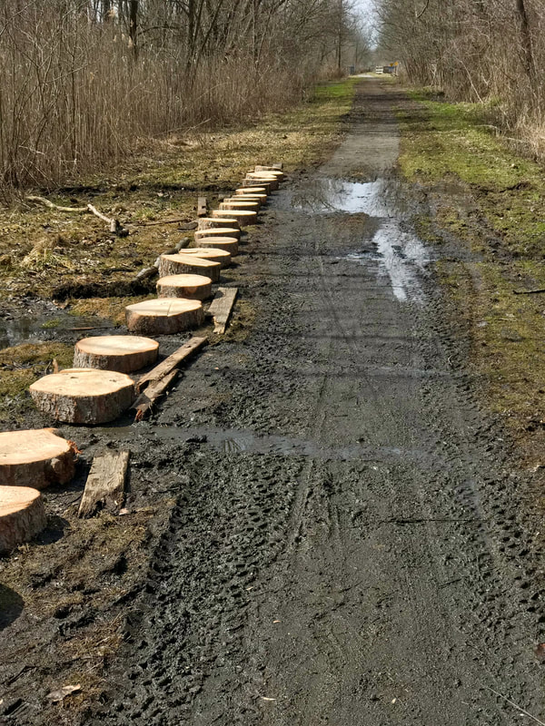 Very cool! Anyway, I wrapped up the day with 57 miles on my slightly modified “5 Trail Loop” … the first of likely several runs this coming year(s).  Sunshine, quiet trails, simply sweet Ride! And ya know what’s REALLY cool about SPRING? It means my skinny bikes can finally come out and play too. 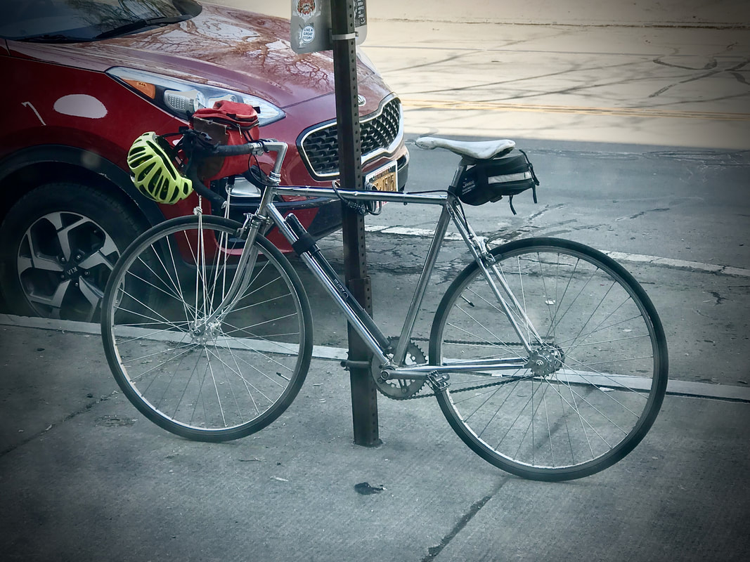 Titanium, Steel, and Single Speed - Let's Go FAST! Got some very preliminary ideas for this year's Adventures, and one already locked in: https://neparkinsonsride.org/the-ride  Stay Tuned!
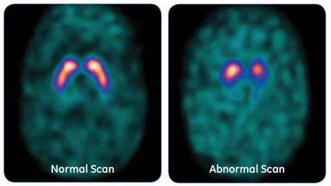 Like Me DaTscan NOT Me In an earlier post, I mentioned “a distraction” that has monopolized quite a bit of my time in the last few months. Not the hernias that seem, in retrospect, a non-issue in comparison. That was dealt with in quick order, and with the exception of two tiny and quickly fading incision scars, hardly deserves any mention at all. The “distraction” started back in the early spring of 2021 with a general wellness exam with my new primary care physician. But more accurately, the distraction FIRST made a significant appearance in May of 2016 when my Route 66 tour group I was leading for Adventure Cycling took a rest day in Santa Fe New Mexico. We were holed up for two nights at a hostel and I had a lower bunk in a co-ed dorm. In a dream one night, I experienced something attacking me and kicked at it. I quickly woke up realizing that yes, I kicked at the offender in my dream, but also kicked at it for real. I kicked so hard, I broke my big toe on the underside of the bunk above me. The tour was challenging enough, but took on a new flavor riding the rest of the route to Chicago with a broken toe. Since then, the frequency of acting out my dreams has increased and Karen can verify that I’ve become increasingly “difficult” to sleep with. (I’ve been told that before, but never really thought about it in quite that way.) In fact, Karen has witnessed / experienced enough of my nocturnal outbursts to raise concerns about it, her own safety in particular. So in the general discussion with my PCP last spring, I noted this issue, asking what might be going on here. I thought perhaps she might recommend seeing a shrink … that would seem reasonable. But no, not a shrink (just yet perhaps), but a sleep study … a polysomnogram. OK … So I go to the University of Rochester sleep center one night, get all wired up and hit the sack. Shortly after, I see the report: “There was increased muscle tone and gross motor activity during stage REM, consistent with REM Behavior Disorder.” Idiopathic REM Behavior Disorder, a parasomnia … aka RBD. “WTF?” I ask. The internet comes to my rescue from ignorance. RBD is a condition where the normal skeletal muscle paralysis during REM stage of sleep doesn’t happen. The reason paralysis is “normal” during REM is exactly so that you don’t do what I’ve been doing … kicking, punching, flailing around, jumping out of bed, etc, etc. … so that you don’t hurt yourself, your bed partner, or destroy your bedroom furnishings. So, the sleep center docs take me under their wing and counsel me on how to prevent injuries. Sleep alone, put your mattress on the floor, remove everything (including weapons … they’re serious … I’ve read the stories!) from the area, pad corners of furniture … essentially create a padded cell. And … there are drugs to help. One commonly used one has some nasty side effects, so they recommend melatonin as reasonably effective, but far safer. OK! So, I hit the interwebs to learn more about this crazy thing, and I learn something else. You could call RBD “brain damage” or “brain disease” if you like, but that’s nothing compared to what it could ALSO be: a prodromal symptom of a synucleinopathy, like Dementia with Lewy bodies, multiple system atrophy (MSA), or … Parkinson’s Disease (PD). Depending on which source I read from … Parkinson’s Foundation, Davis Phinney Foundation, Michael J. Fox Foundation, NAPS Consortium for RBD … I see estimates of between 75 to 91% of people with RBD eventually develop Parkinson’s primarily, and the other two significantly less frequently, but no less scary. To be honest, I’ve never been the kind of person who ever thought: “Oh, that will never happen to me!” like so many people do about things like getting caught drunk driving, dying of cancer, or getting killed skydiving. Getting close to the last of those three taught me otherwise. And I learned a lot about the research that’s been done to date regarding risk factors for PD. They say genetics loads the gun, but environmental factors pull the trigger. Suspected risk factors include: 1. Exposure to heavy metals. Does melting lead bullets on a skillet in the kitchen as a kid to pour into molds to make fishing sinkers count? How about working in the foundry of a car battery factory molding the lead grids? 2. Head trauma. That wicked crash on my mountain bike where I did a pile-up on my head, ended up in ER with a concussion, and was a spinal wreck for a good 6 months before I could even get back on the bike … I still occasionally visit the bone jerker to unkink the neck. 3. The “gut-brain axis” … H. Pylori infection. Check! Even ended up with a duodenal ulcer. 4. Industrial solvents: Trichloroethane. 15 years in mold making and using “T” on a nearly daily basis. Check! I understand enough about statistics and risk factors to recognize what that 75-91% mentioned above really could mean for me. I’ve read all of Michael J. Fox’s books and I’m reeling at the impact on his life, but damn thankful for what he’s accomplished. I’m learned that some friends in the bike club have volunteered to ride and raise money for Parkinson’s research because it hit close to home for them. And I’ve also learned that a couple friends in the club have developed PD, and that helps me face the statistics as well. So what to do? Volunteer! What have I got to lose? I plan to join the bikers in the next Ride for Parkinson’s this year to raise $$ for the Fox Foundation, but that doesn’t seem like quite enough when I could help with a clinical study, and there IS one the UofR is involved with … the Parkinson’s Progression Markers Initiative (PPMI) funded by the Fox Foundation. They need people who have “risk factors” (RBD being a big one) but not yet diagnosed and taking meds for PD. That’s me, so I sign up to volunteer! They have to screen candidates for the study and step one is a smell test. It seems loss of smell (NOT related to COVID, obviously) is an early sign. Karen has always commented on how I can’t seem to smell anything she picks up easily. I assumed my nose was blown out from trichlor! I take the test and wait for results. The next thing I know, I’m asked to proceed to the next screening test. I guess I failed that one spectacularly! The next step is a DaTscan. It’s a brain imaging test that can see dopaminergic activity, or the lack thereof, in the area of the brain that’s responsible for PD. I get that done, and wait. I got a call back from the PPMI study coordinator at UofR. The DaTscan results: +++++++++++++++++ FINDINGS: There is bilateral normal symmetric uptake within the putamen and caudate nuclei. Impression Findings not suggestive of Parkinsonian syndrome. +++++++++++++++++ I’m NOT eligible to participate in the study. And I found myself quite disappointed, a bit sad. Too much time as a Boy Scout, too much time as a Coast Guardsman, too much time volunteering for all kinds of things over a lifetime has kinda made my life all about serving and helping others. And here, where I thought I might have a way to really help find a way to stop this terrible disease, I’m not invited. But then, a sigh of relief. A huge weight off my shoulders. I realize that I’m a statistical anomaly. I’m surprised considering all the risk factors (and some non-motor symptoms) I’ve checked the boxes on. That’s not to say there’s NO chance I might have something develop later, and I still have to deal with the ongoing impact of RBD, but for the moment I’m happy to know I’m NOT expected to develop PD. I’ve dodged the bullet. For a comedian's take on RBD ... funny ... but ... https://www.youtube.com/watch?v=B02NsP33pRM&t=7s Now, back to Biking! What a difference 24 hours can make! 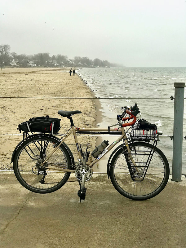 Saturday, New Year's Day: 46 miles / 40 degrees 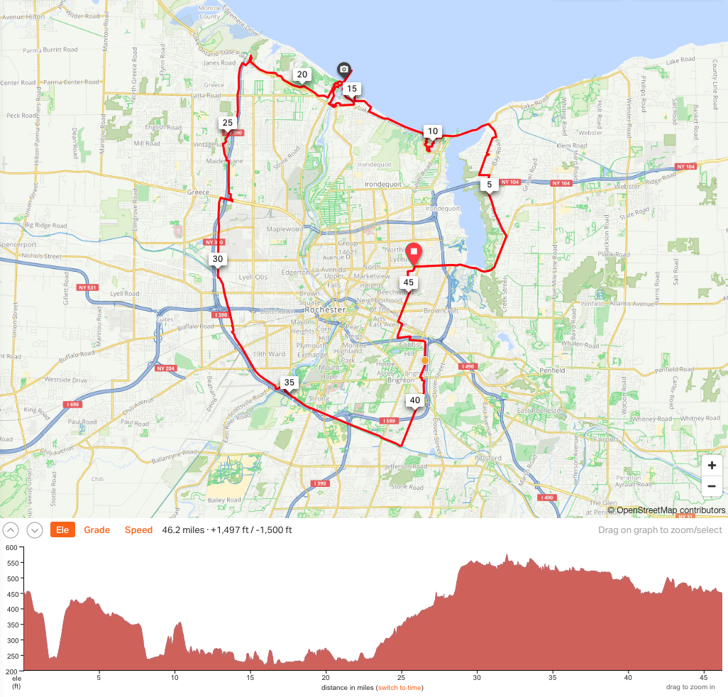 A cool and foggy / windy day to start the New Year. But then ... 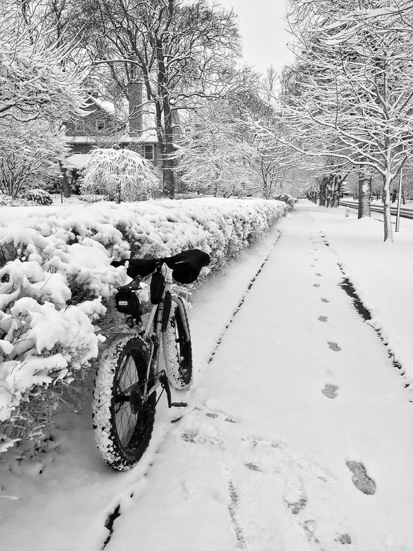 Sunday, January 2nd: 15 miles / Snow and Ice 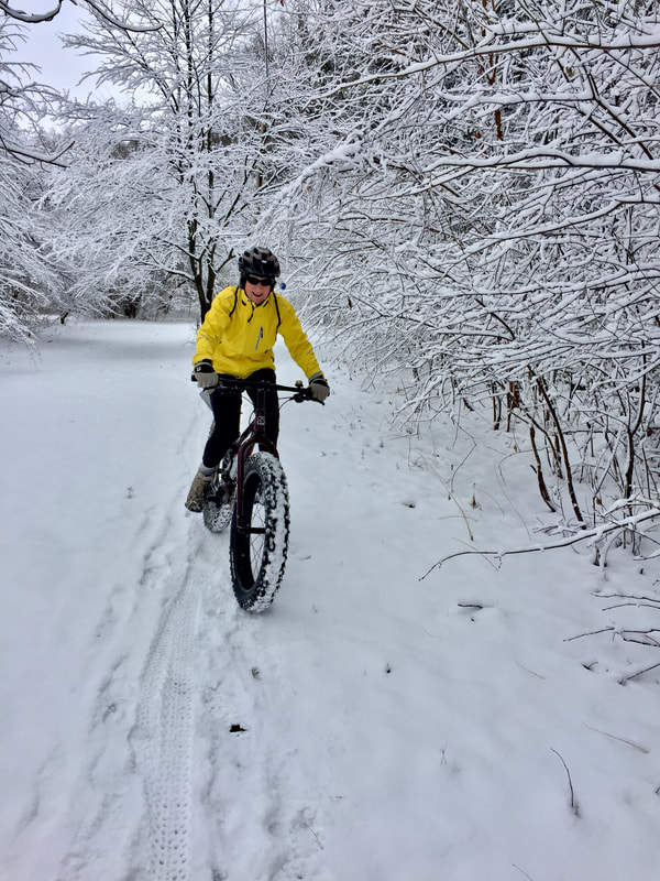 Karen fatbikin' in Cobbs Hill Park 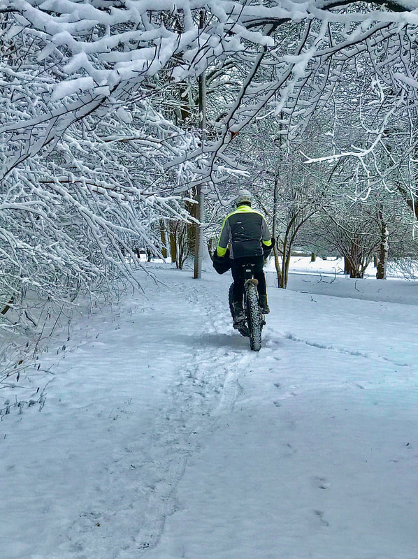 Me too! 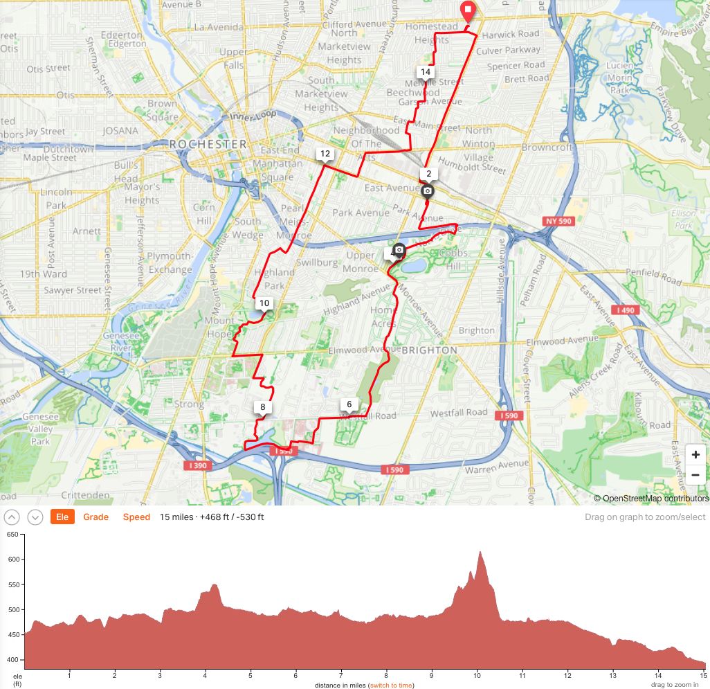 2022 off to a great start! Cheers!
 Heatmap: Purple lines indicate rides in 2021. Or thereabouts. Wrapping up '21, I’m at the ‘puter now after we enjoyed a really nice ride today, Dec. 31st, with our friends, A&C. 31 miles. 45 degrees. Little if any wind and partly cloudy. The only hitch was my rear flat tire … the second in three days. I’ve had enough flats this year to cover all of ’22 … I think that’s fair. I did a lousy job of tracking my biking miles this year (2021). I let RWGPS track and record all my “real” rides, but I neglected to let it record the gazillion of commutes to the gym and back. There. I said it. I went to “the gym”. Never thought I’d say that. I always questioned why someone would drive to a gym to workout when they could ride a bike out the door of their house and have a lot more fun, stay out longer, and burn more calories. (At least, I never DROVE to the gym!) But heck … my gym membership is free because my insurance pays for it, and I’ve been inspired by a revelation this year which may be detailed in a later posting. So, we even splurged to hire a personal trainer for 6 months just to get ourselves started. Given that my only “weight training” experience involved a lot of heavy lifting in multiple factory jobs in my younger days and pressing 100+ pound steel plates overhead while working in a prior career as a plastics mold maker, I figured learning how to do things correctly might not be a bad idea. Better late than never! I’ve traumatized my body with enough broken bones and torn connecting tissues over the years that I don’t think I have a lot of UN-injured parts left to sacrifice. I guess I play a little too hard. Or, I’m just terribly uncoordinated. But anyway … that gym time took a hit on my bike mileage this year. 2020 was much better with over 11,000 miles, but I’m OK with 8400 (or 8500, or 8600 …whatever). But two or three days a week at the gym for almost 6 months DID have it’s payoffs, however. I hit my lowest weight / BMI / BMR ever since boot camp, could do a plank for FIVE MINUTES, and on the bike, I could climb hills like a raped ape. OK!! But let’s not blame the gym for sucking up ALL my time off the bike. Then there was the hernia. Or two, actually. Now, full disclosure … I knew I had a hernia for years before the gym thing. I didn’t bust anything working out. Well … not there anyway. More likely from schleppin’ overweight luggage for bike tour guests who can’t follow simple instructions on gear limitations. A DOT physical revealed the hernia years ago, and I was TOLD to see a surgeon about that. (It didn’t bother me so …) But I got a new Doc this year, and she told me: Get it fixed! OK, OK! I mentioned to the surgeon that I had another “bump” nearby that had been there as long as I can remember. Turns out, I had TWO hernias to fix. So all that set me back with over a month off the bike! All stitched back up, and back on the bike, and feeling’ great! But then … there’s that “other distraction” that’s on my mind. Sadly, I neglected to share the story of a wonderful 4-day bike camping tour down into the southern end of the Finger Lakes with Karen, Todd and Dave, because I’ve been so distracted, but I’ll get to the tales of that adventure later … really. It was likely THE highlight of the year for me. 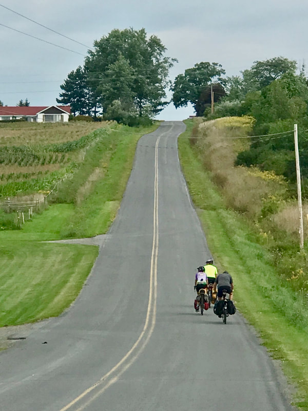 Yeah, it was a little hilly. I’ve been on the ‘puter doing a lot of research in the last year, particularly the last 6 months, and since I don’t have the right “confirmation” to share just yet, I’ll save that discussion for a later post ... perhaps in just a few weeks. Stay tuned. So, 2021 was a disrupting year. My sweet sweet kitty Ziplock passed away, I did no BIG tours, I got laid up for longer than planned, and I discovered a potential “issue” to deal with looking forward. But I might have big dreams and adventures in the works for ’22! Happy New Year! Just another (century) ride. Nothing special, just an easy loop on a rare day of low temps and low humidity. Well, THAT’s kinda special in late August, wouldn’t ya think? But I got rolling early. Out the door at 6:30am … in case it DOES get hot. But it’s a special, special day ‘cause I’m ridin’ the FrankenTrek with NEW TIRES! Yeah … that last episode of riding a front flat in from 5 miles out on the Independence Century (after flatting THREE times) has made me question if going long on the FT is a bit too risky, given that the bike is jinxed with flats. Even with Conti Gatorskins, that I’ve always loved, this bike just can’t seem to stay on the road. So, new tires, new tubes … and can ya believe it … I actually finished this day’s century w/o a hitch. 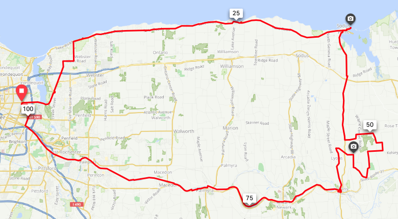 Headwinds increased a bit as I approached Sodus Point, and they were on full display at the beach and breakwalls at the bay, with huge waves crashing and throwing spray 30 feet in the air. 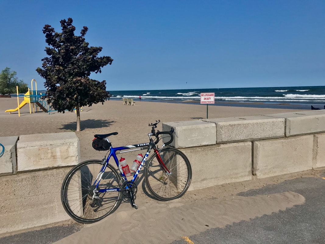 Exciting to watch, as well as the kite surfer who was having mostly good luck staying upright. But bummed that the food stand wasn’t open. Alas, the c-store at the corner met my basic needs of Spicy Chili Doritos (400 calories and 28% daily sat-fat!) and a coke. Southbound on NY14 toward Lyons, I veered off the highway to take in some gorgeous farm country views on Klippel Road, which reminded me of the rolling Flint Hills of eastern Kansas, without the gravel. That extra loop was added to help meet my century mark. Easy decision. 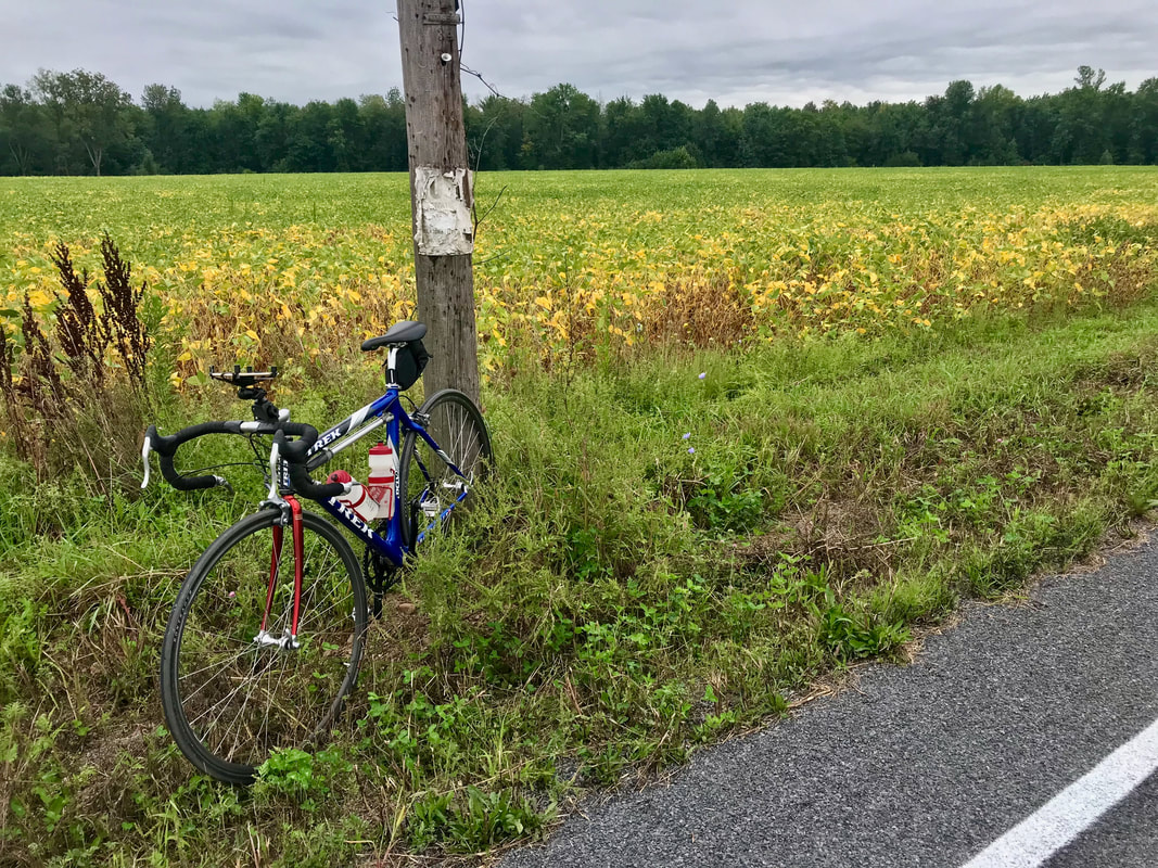 In Lyons, I grab a coke at the Sunoco station and decide to just hop on the Canal trail for the quiet, yet surprisingly quick cruise back to Rochester. I did stop briefly at the Pal-Mac park to do some stretching as I’m not used to being so stretched out on long rides on my road bike, but I do see the advantage! 102 miles in 7 and 1/2 hours is not the numbers I get on any other bike. OK … the FrankenTrek is (probably still) jinxed, but it IS the speedstar in my fleet. Keep Rolling! Postnote: I just realized that I admitted to having only two cokes and a bag of Doritos to fuel the day's ride. But that's incorrect! I had Cheerios for breakfast!) Beechwood State Park. Ever hear of it? Maybe if you were a Girl Scout long ago. Or maybe if you’re a Sodus area resident, you may have wandered in after hearing from friends. Or, maybe you’re a cyclist who has ridden out Lake Road countless times and finally decided to go check out this tiny pocket of damn near wilderness pine forest. That was me back in April when I took a ride to the east and discovered a GEM of a campground. Beechwood State Park, long ago abandoned by the Girl Scouts and handed over to NYS, is managed by the Town of Sodus and the “super” (Sal V.) overseeing the property lives practically on-site. Wanting to get more “under-the-stars” time, I cajoled a gang of friends to join me for a bike-overnight out to Beechwood … roughly a flat 40 spin from our place. Dave and Todd arrive at our place … 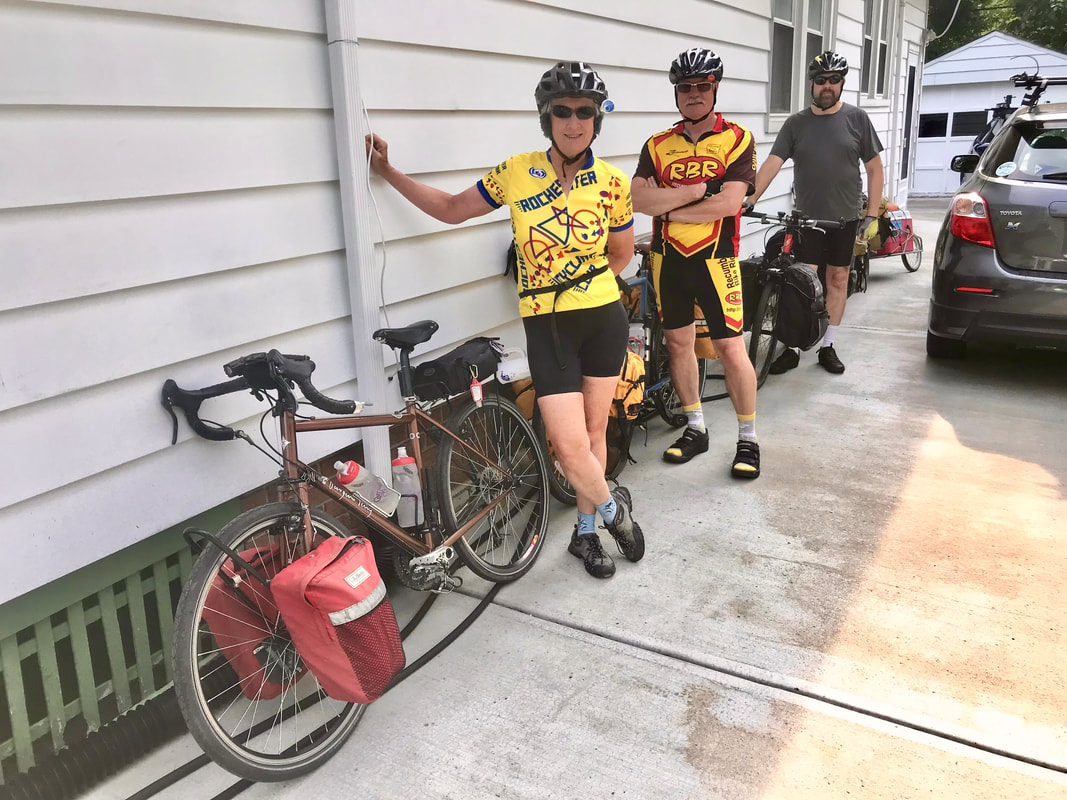 … and together with Karen, we four head to Steve’s where we pick up Steve, Joe and Andy. 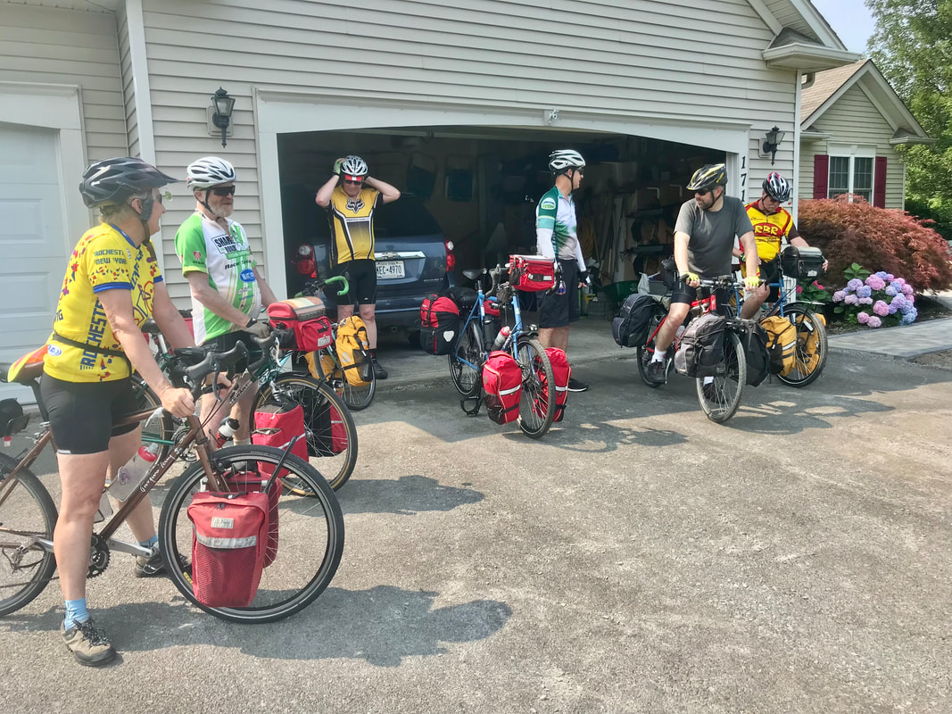 And off we go! Taking frequently used and familiar roads out to Wayne County, we dipped briefly into Williamson to grab some lunch. Joe suggested a short detour off-route to the village park “behind the school” … across the grass. So I promptly steered us wrong down a driveway into a cemetery … with grass … thinking I found the spot. 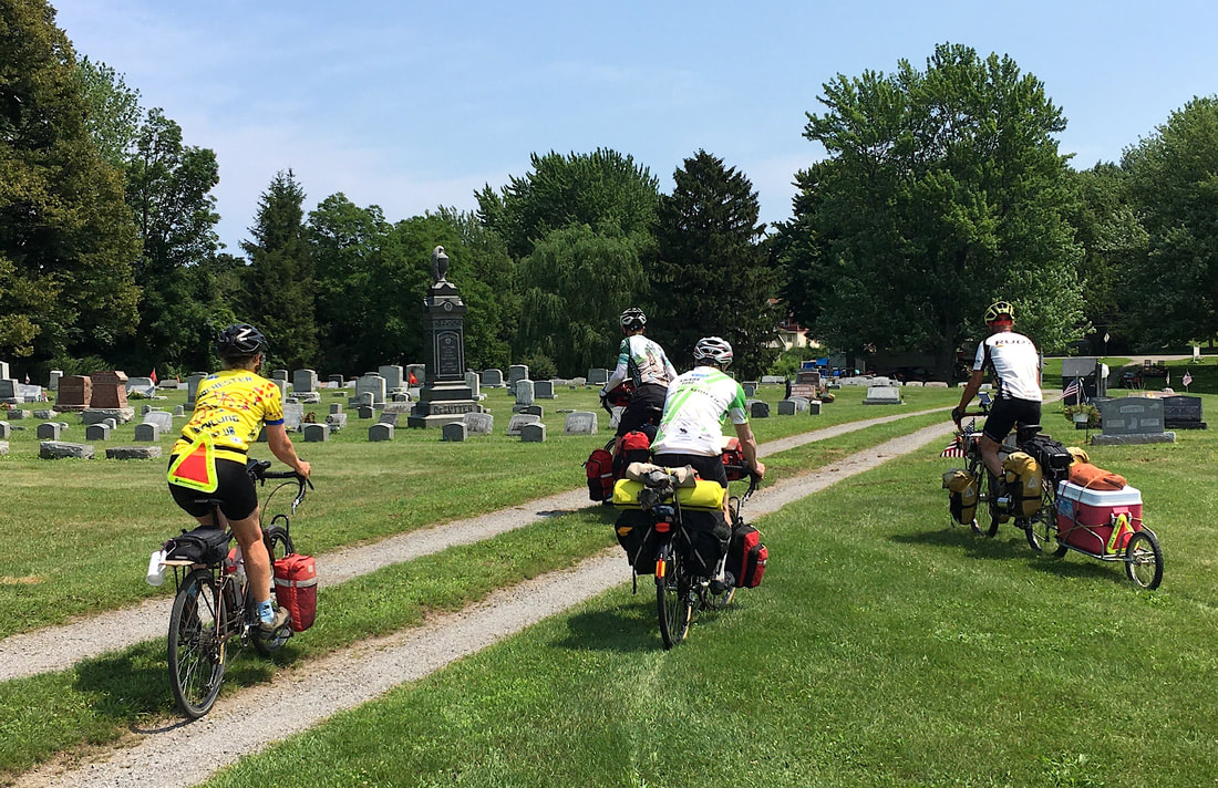 But no … the park is waaaaay over there! Down the road, up a hill … through the grass. We get to the ball fields, and find picnic tables, water, porta-pot and shade. Cool! 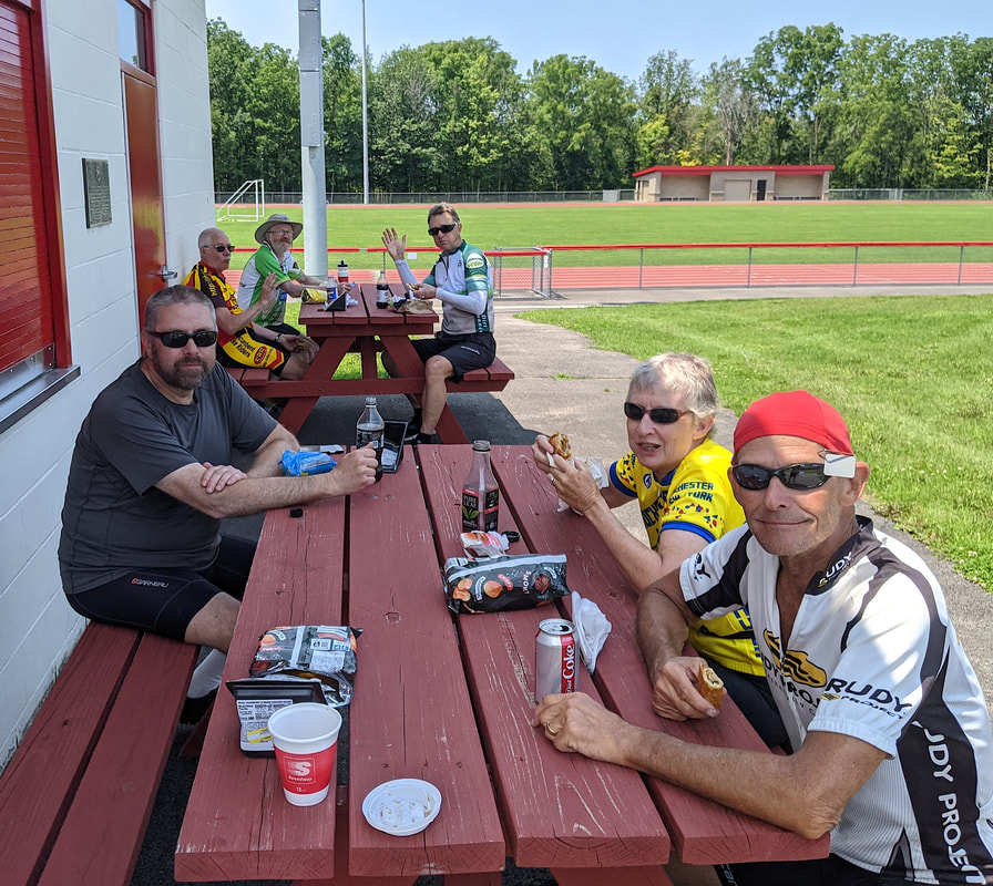 Exiting the park, we head right out a driveway. Did we see the driveway beforehand? No. Would we have used it if we had? Likely not. Joe wanted to share an adventure and we all cooperated, of course. Back on route, we meander down Old Ridge Road and into Sodus where we stopped to gather supplies for the evening. Subs, drinks, and ice. Uh, ice? Yup. Figuring a cold drink at camp is worth a little extra effort, I had selected my Surly Long Haul Trucker to be the bike for this trip, partly because it’s too easy toss a set of panniers on, but also because that’s the bike that pulls my Bob trailer. I found that a mid-sized Coleman cooler fits perfectly on the deck of the Bob. 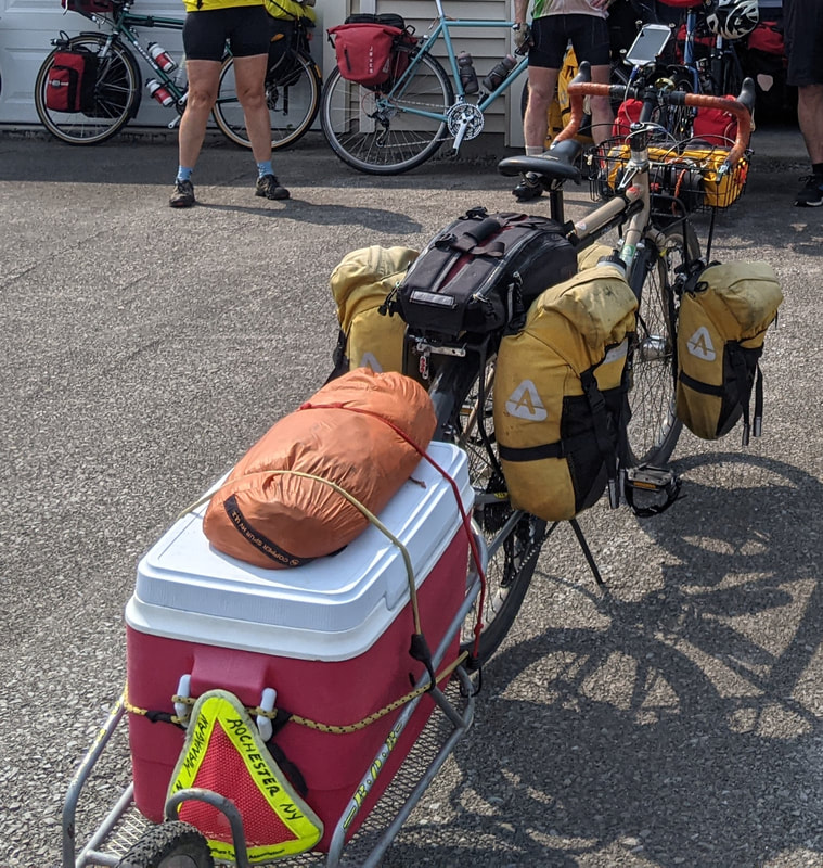 We loaded 3 bags of ice, cold drinks and sandwiches into the cooler and off we went … slowly at first. It took me a few miles to adapt and “smooth out” the huge handling differences of the bike after loading up the cooler, but it became manageable in short order. The trick really turned out to be simply relaxing MORE, letting the bike find it’s line, and supply only essential steering input. The snake-like motion of starting out quickly settles into an easy cruise if you don’t hammer it. The extra weight makes crossing busy highways a real adventure, but otherwise, it’s quite fun rolling a bike down the road that FEELS like an 18-wheeler. Yeah, I know … only a rabid bike-geek would find that “fun”. Guilty! We arrived at the park … 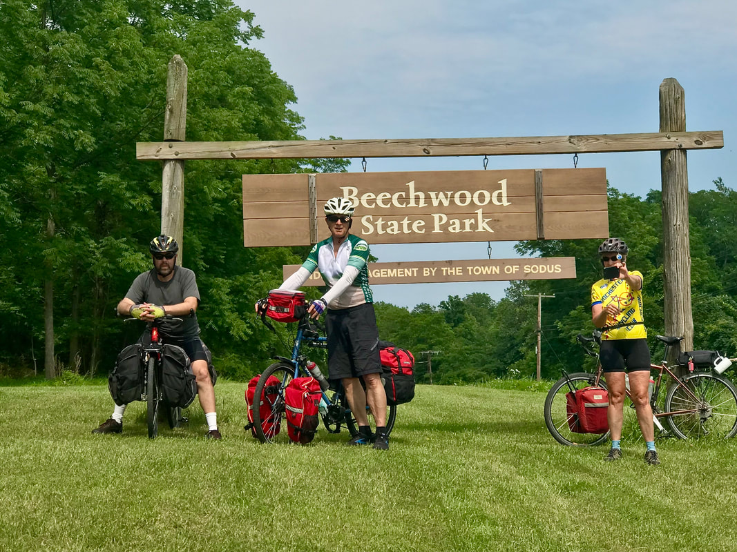 … and took little time to decide on where to pitch tents. 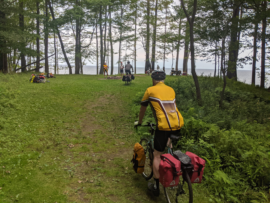 Perfect! Nice wide open grassy area on a short bluff overlooking Lake Ontario and a fire ring in the middle of it. Best Part? Soft ground that you can drive a tent stake in with NO effort at all. It doesn’t take long before we start settling in. Tents go up … 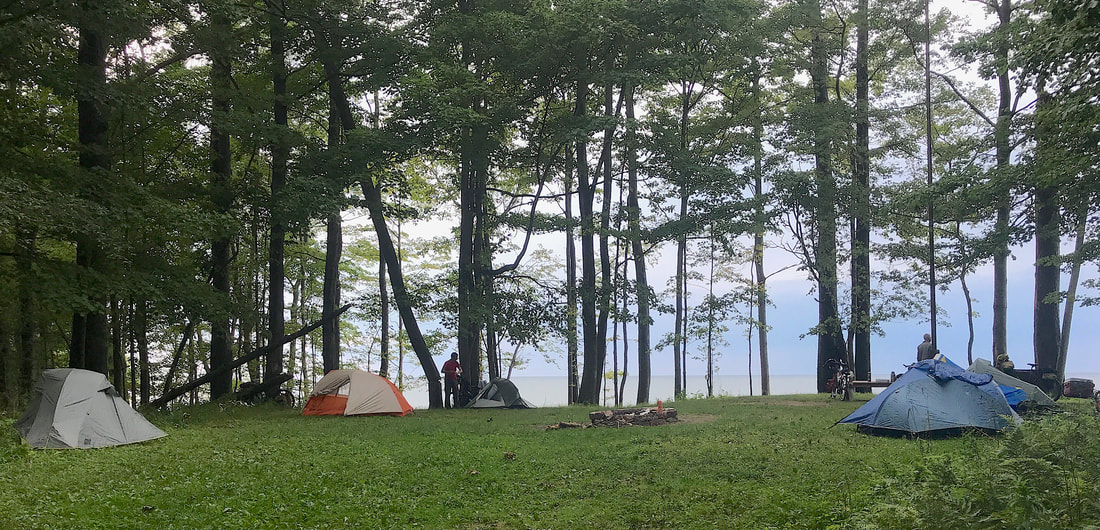 … food explodes from panniers … 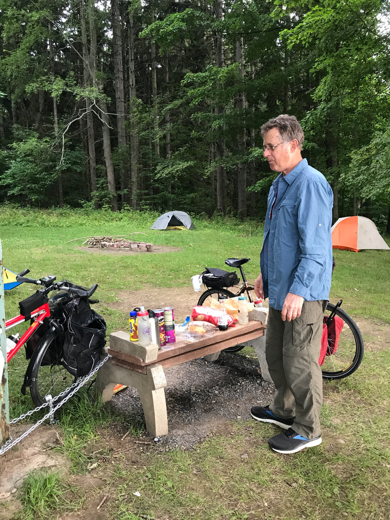 … and we enjoy some quiet time awaiting the advancing sundown. 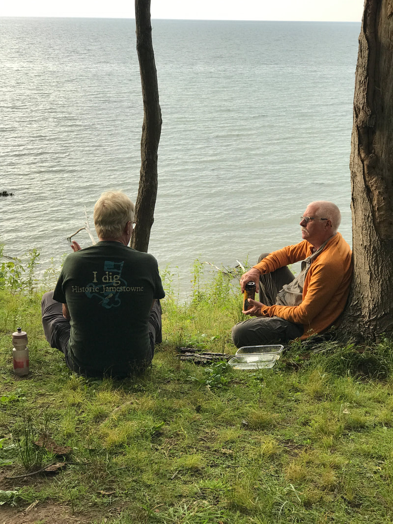 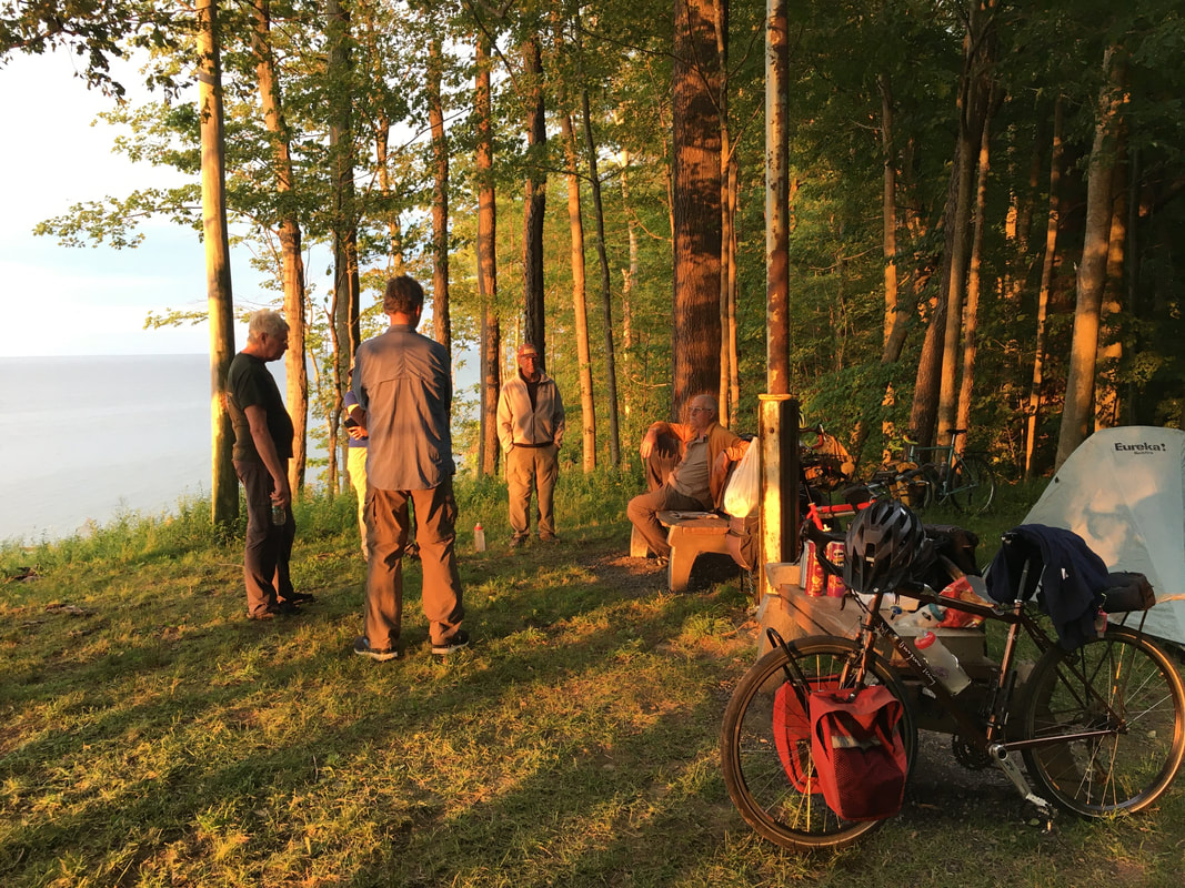 Some of the gang did a little exploring of the park earlier, and found the detritus of the days when this was a Girl Scout camp. 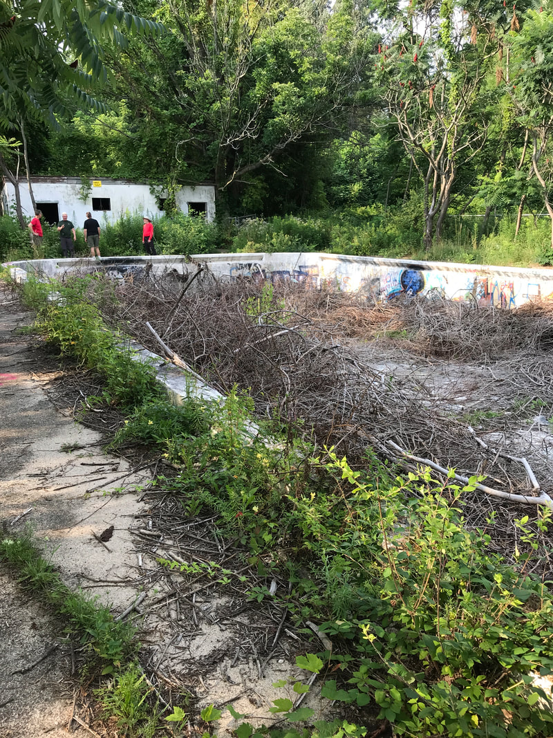 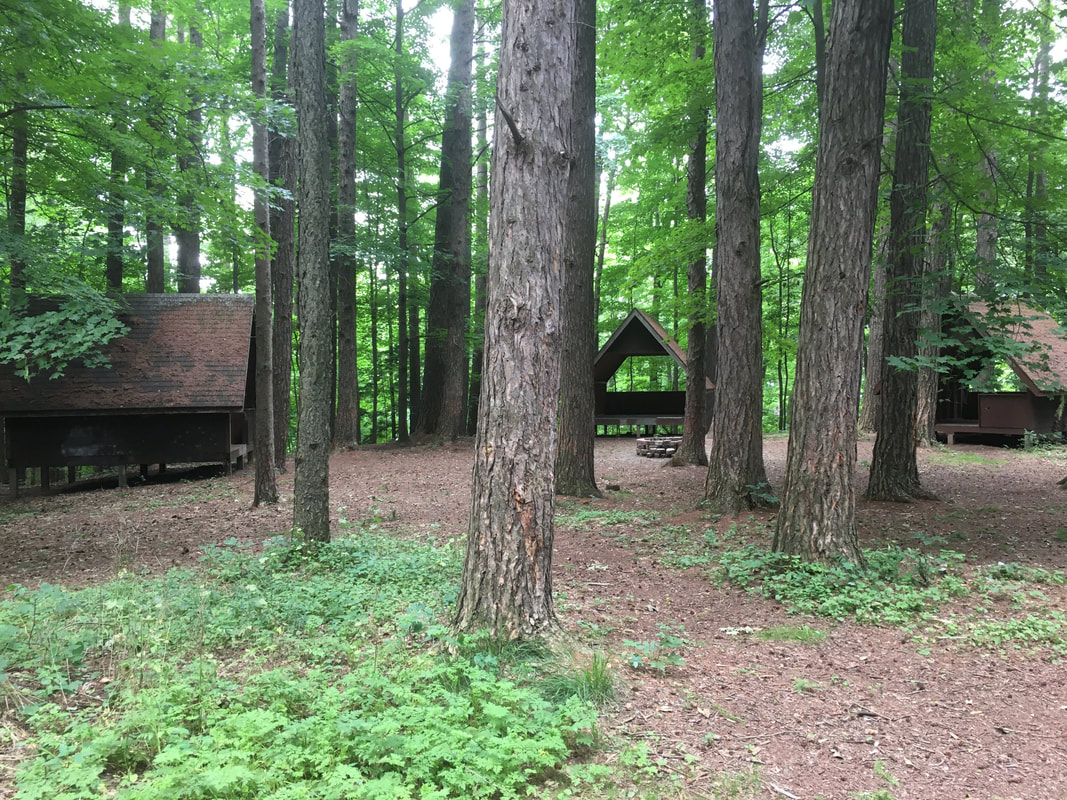 And yes ... these lean-tos ARE available for camping. The pool needs work though. And, then we have a stunning Sundown! 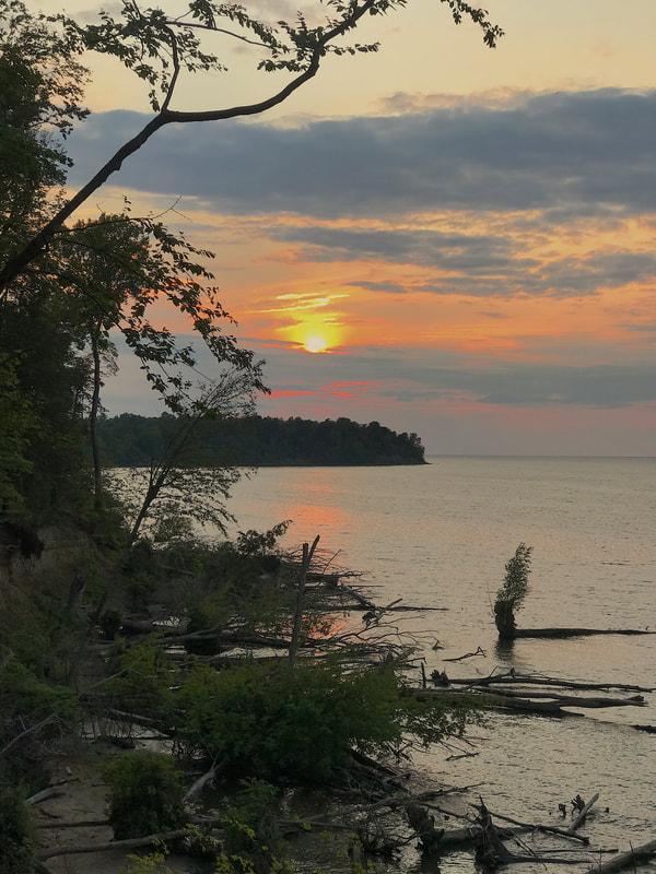 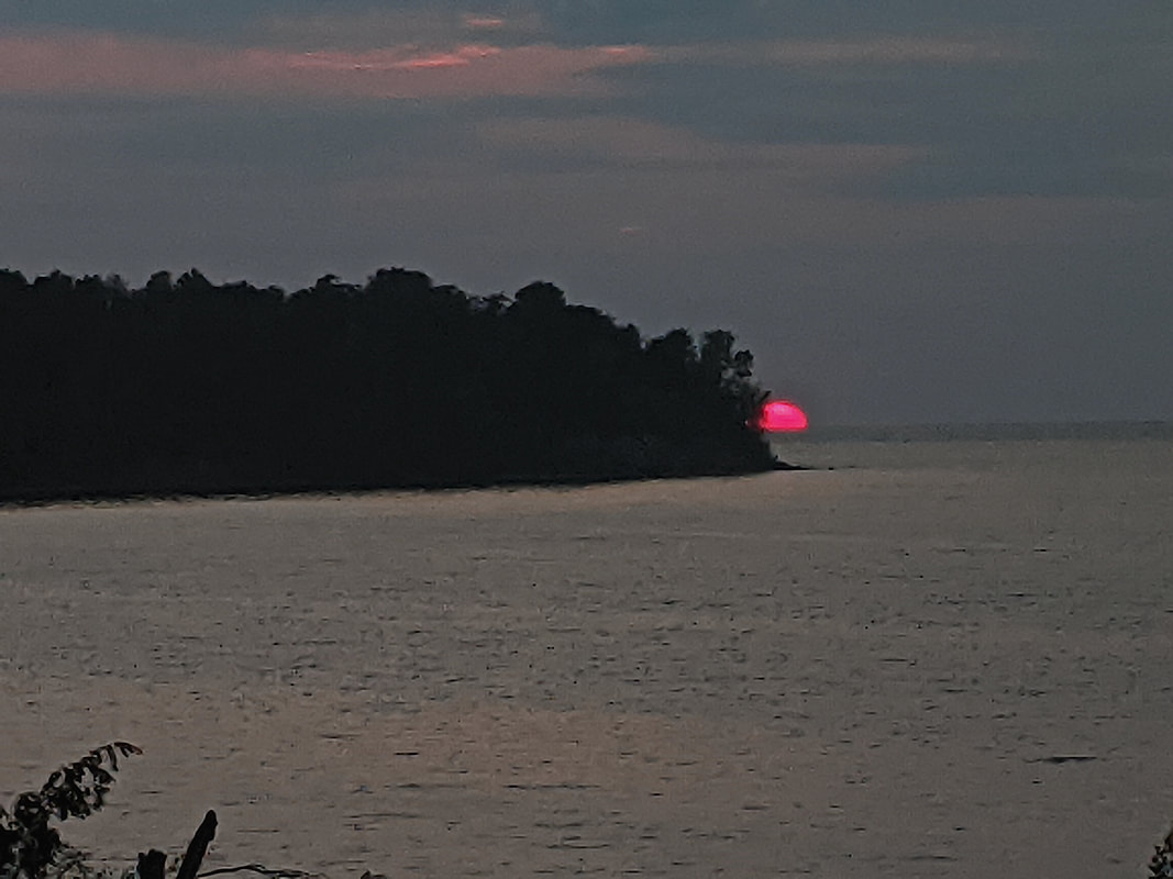 Time for a campfire … 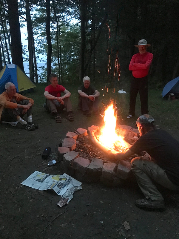 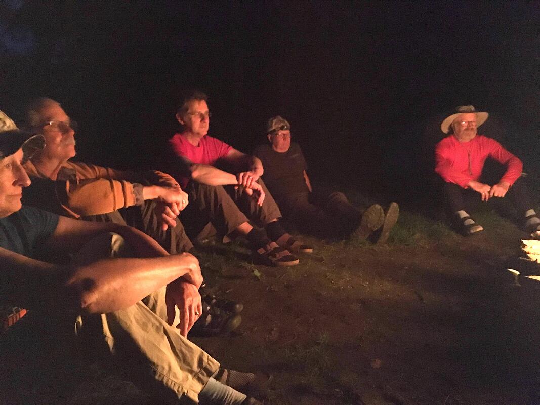 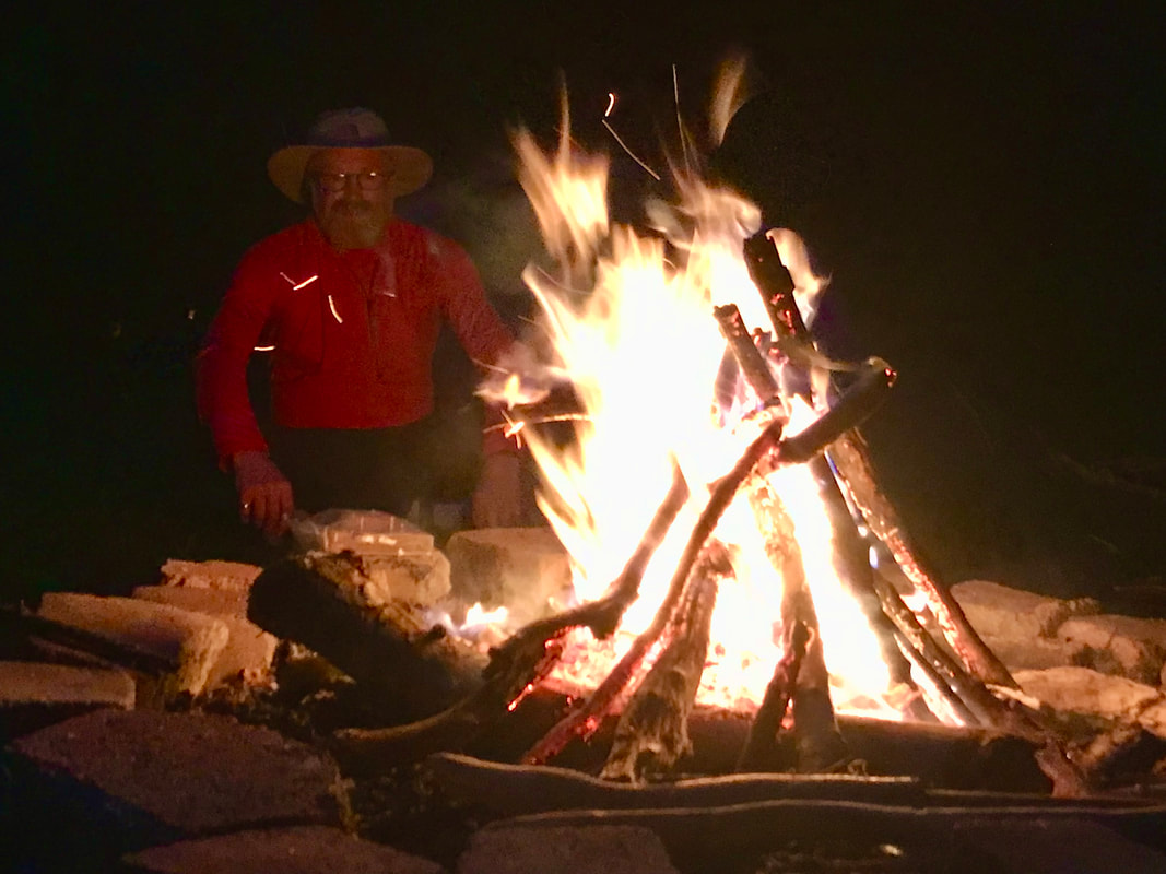 A beautiful night’s sleep (speaking for myself … I was exhausted), and we’re up the next day headed for breakfast! Joe suggested we try Nick’s on Old Ridge Road and that was a winner! I got my corned beef hash benedict and way too much coffee.  Must have been the coffee, or maybe the lightened load on the trailer (all fluids had been disposed of), but I was feeling my oats in the morning.  But maybe it was the candy! We stopped in Williamson to check out the Candy Kitchen and I scored some cashew-chocolate things. (Can't wait to get home and ...) 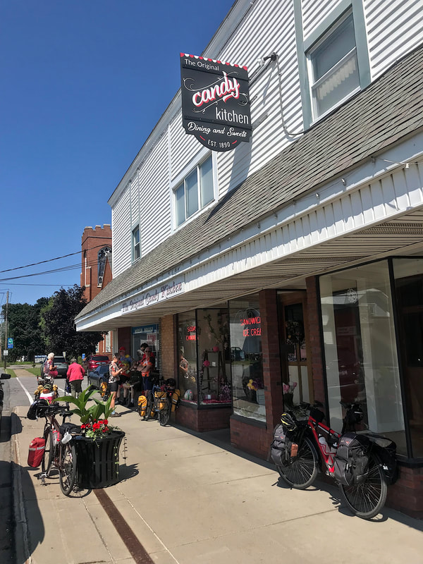 On the way back west toward home, we started splitting up for our respective homes. But Todd, who parked overnight at our place, willingly followed Karen on a special reward detour: Netzin’s Ice Cream. 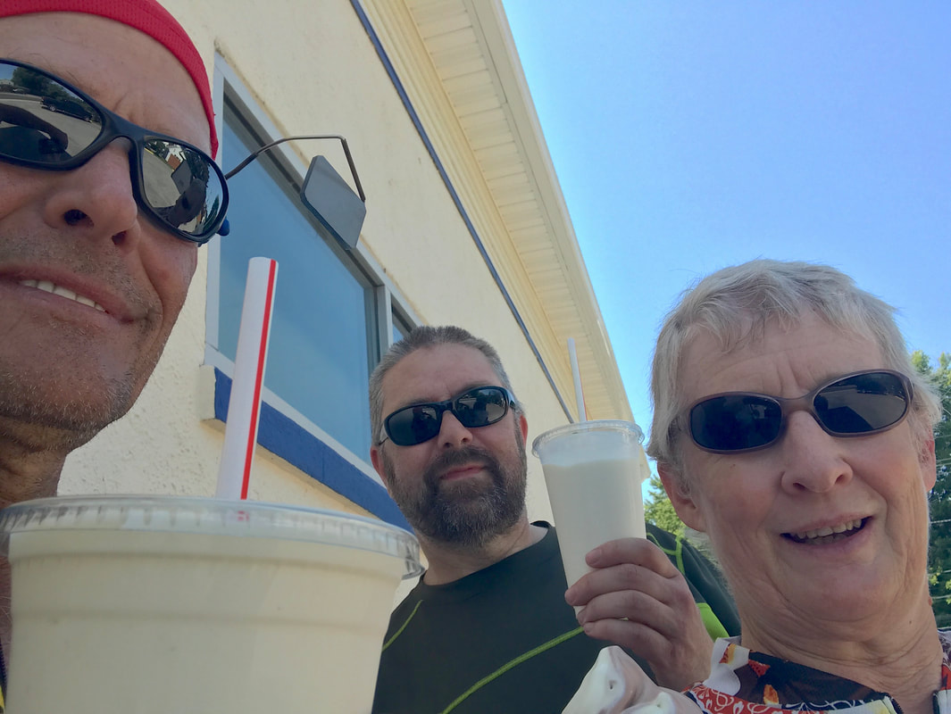 That's How We Roll!
|

In the Finger Lakes

Slow Rides
Archives
October 2024
|
 RSS Feed